
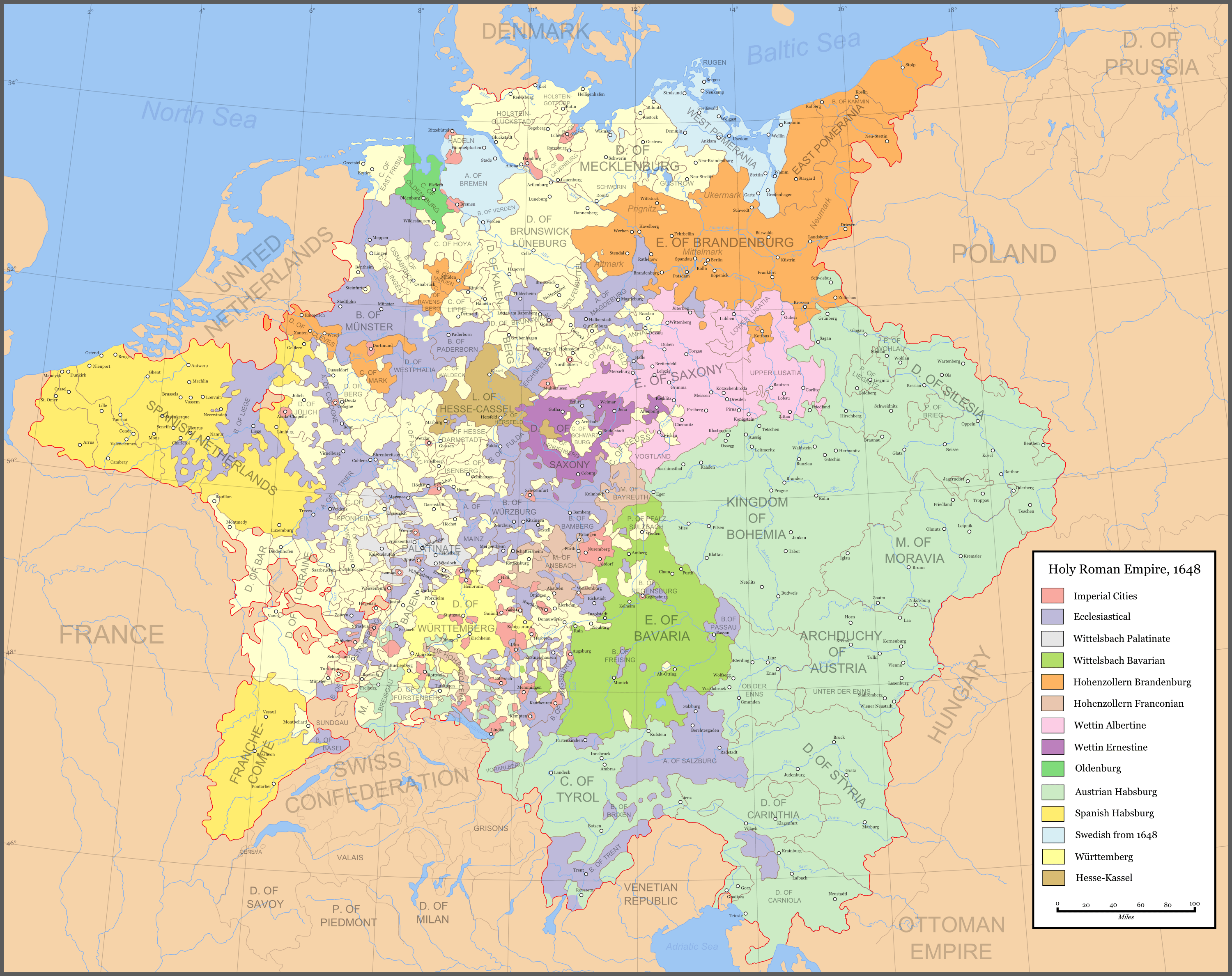
Image: Holy Roman Empire 1648
Description: Map of the Holy Roman Empire in 1648, after the Peace of Westphalia. This is a png version of the original svg. Uses the colour scheme of Wikipedia:WikiProject Maps and the free to use Color Brewer. Imperial cities Ecclesiastical lands Wittelsbach Palatinate Wittelsbach Bavarian Hohenzollern Brandenburg Hohenzollern Franconia Wettin Albertine Wettin Ernestine Oldenburg Austrian Habsburg Spanish Habsburg Swedish after 1648 Württemberg Hesse-Kassel
Title: Holy Roman Empire 1648
Credit: Made from the public domain map from the Perry-Castañeda Library Map Collection at the University of Texas This PNG graphic was created with Inkscape.
Author: Astrokey44
Permission: self made
Usage Terms: Creative Commons Attribution-Share Alike 3.0
License: CC-BY-SA-3.0
License Link: http://creativecommons.org/licenses/by-sa/3.0/
Attribution Required?: Yes
Image usage
The following 2 pages link to this image:
