
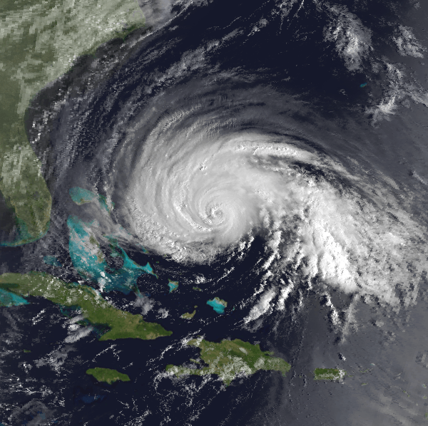
Image: Hurricane Gloria 25 Sep 1985 1241z
No higher resolution available.
Hurricane_Gloria_25_Sep_1985_1241z.png (600 × 598 pixels, file size: 544 KB, MIME type: image/png)
Description: Satellite image of Hurricane Gloria of the 1985 Atlantic hurricane season taken by the NOAA-8 weather satellite at 1241 UTC on September 25, 2008. At the time, Hurricane Gloria had just weakened from its peak intensity, with maximum stained winds of 135 mph (215 km/h) and a minimum pressure of 926 mbar (hPa; 27.35 inHg).
Title: Hurricane Gloria 25 Sep 1985 1241z
Credit: Satellite data = [1] Land and ocean data = [2] This image was created using these two sources.
Author: NOAA
Usage Terms: Public domain
License: Public domain
Attribution Required?: No
Image usage
There are no pages that link to this image.

All content from Kiddle encyclopedia articles (including the article images and facts) can be freely used under Attribution-ShareAlike license, unless stated otherwise.