
Image: Hurricane Irene radar North Carolina
No higher resolution available.
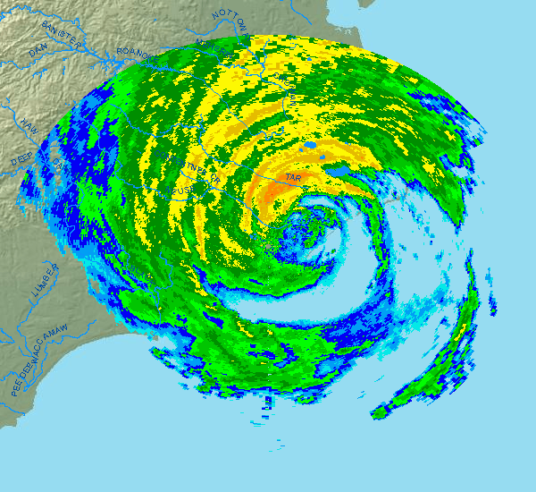
Hurricane_Irene_radar_North_Carolina.png (600 × 550 pixels, file size: 171 KB, MIME type: image/png)
Description: Radar image of Hurricane Irene shortly after making landfall on the Outer Banks of North Carolina. Image was taken on 2011-08-27 at 14:05 UTC (10:05 local time) from the National Weather Service radar station at Newport/Morehead, North Carolina.
Title: Hurricane Irene radar North Carolina
Credit: http://radar.weather.gov/radar.php?rid=mhx
Author: National Weather Service
Usage Terms: Public domain
License: Public domain
Attribution Required?: No
Image usage
There are no pages that link to this image.

All content from Kiddle encyclopedia articles (including the article images and facts) can be freely used under Attribution-ShareAlike license, unless stated otherwise.