
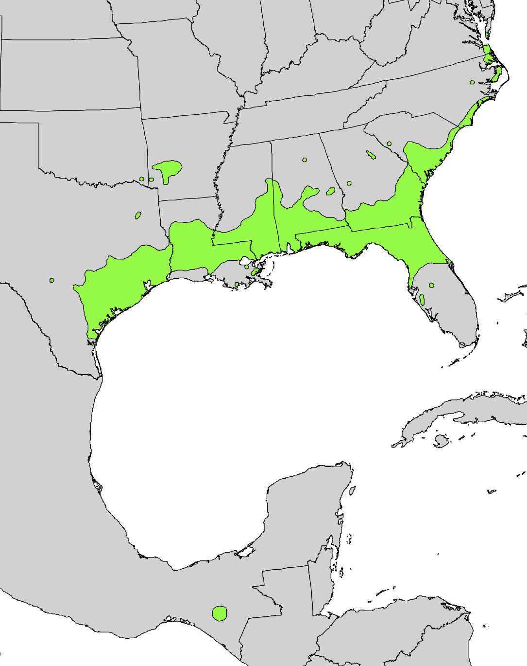
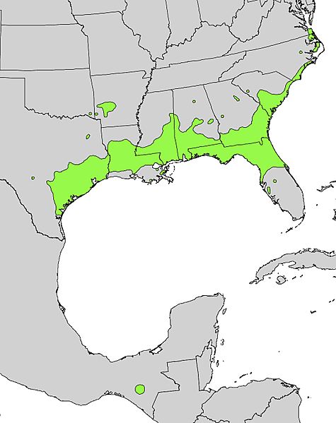
Image: Ilex vomitoria range map
Size of this preview: 475 × 599 pixels. Other resolutions: 190 × 240 pixels | 1,085 × 1,369 pixels.
Original image (1,085 × 1,369 pixels, file size: 281 KB, MIME type: image/jpeg)
Description: Range distribution map of Ilex vomitoria in eastern North America.
Title: Ilex vomitoria range map
Credit: Digital representation of "Atlas of United States Trees" by Elbert L. Little, Jr. [1]
Author: U.S. Geological Survey
Usage Terms: Public domain
License: Public domain
Attribution Required?: No
Image usage
The following page links to this image:

All content from Kiddle encyclopedia articles (including the article images and facts) can be freely used under Attribution-ShareAlike license, unless stated otherwise.