
Image: Illinois 1718
Size of this preview: 479 × 599 pixels. Other resolutions: 192 × 240 pixels | 589 × 737 pixels.
Original image (589 × 737 pixels, file size: 232 KB, MIME type: image/jpeg)
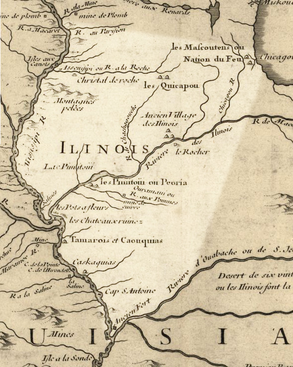
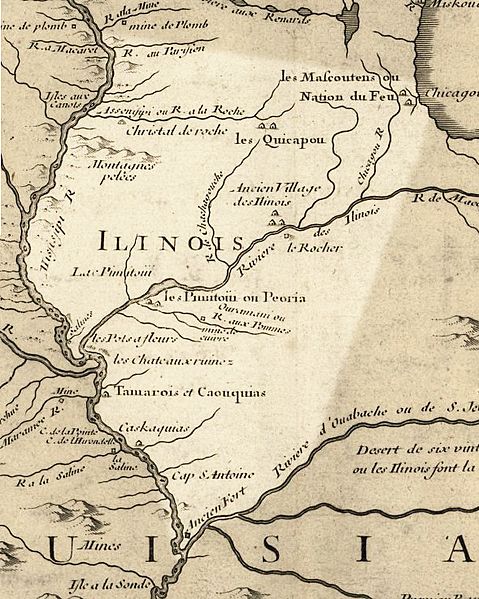
Description: Illinois in 1718, approximate modern state area highlighted, from Carte de la Louisiane et du cours du Mississipi by Guillaume de L'Isle. This map shows Chicago as being the strategic point of connection between the Great Lakes and the Mississippi River Basin.
Title: Illinois 1718
Credit: Library of Congress Public Domain Site: http://hdl.loc.gov/loc.gmd/g3700.ct000666 Modified by en:User:Billwhittaker to highlight Illinois
Author: Guillaume Delisle
Permission: US Govt Public Domain, also author +100 years
Usage Terms: Public domain
License: Public domain
Attribution Required?: No
Image usage
The following 5 pages link to this image:

All content from Kiddle encyclopedia articles (including the article images and facts) can be freely used under Attribution-ShareAlike license, unless stated otherwise.