
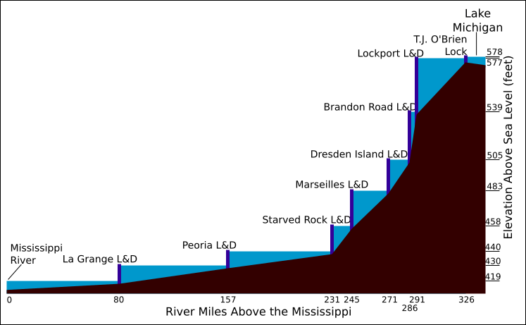
Image: Illinois Waterway schematic

Description: Schematic of the Illinois Waterway from the Mississippi River to Lake Michigan. X-axis = river miles. Y-axis = elevation above sea level. Drawn by myself, based on US Army Corps of Engineers data sheet at [1].
Title: Illinois Waterway schematic
Credit: Original artwork by DanMS.
Author: Daniel M. Short
Permission: This work is licensed under the Creative Commons Attribution-ShareAlike 2.5 License. Attribution: Attribution to D.M. Short https://creativecommons.org/licenses/by-sa/2.5/CC-BY-SA-2.5Creative Commons Attribution-ShareAlike 2.5truetrue
Usage Terms: Creative Commons Attribution-ShareAlike 2.5
License: CC-BY-SA-2.5
License Link: https://creativecommons.org/licenses/by-sa/2.5/
Attribution Required?: Yes
Image usage
The following page links to this image:
