
Image: Indian Heaven Volcanic Field and Mount Adams Volcanic Vicinity Digital Relief Map

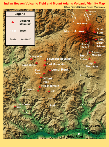
Description: The South Cascades region of Washington (mainly the Gifford Pinchot National Forest) is characterized by ancient volcanic activity. The map shows the locations of the major eruptive volcanoes in the region from the Wind River to the 60 eruptive centers which lie on the Indian Heaven fissure zone, northeast to the King Mountain fissure zone along which Mount Adams was built.
Title: Indian Heaven Volcanic Field and Mount Adams Volcanic Vicinity Digital Relief Map
Credit: National Forest Service
Author: Employee of the National Forest Service
Permission: This work is in the public domain in the United States because it is a work prepared by an officer or employee of the United States Government as part of that person’s official duties under the terms of Title 17, Chapter 1, Section 105 of the US Code. Note: This only applies to original works of the Federal Government and not to the work of any individual U.S. state, territory, commonwealth, county, municipality, or any other subdivision. This template also does not apply to postage stamp designs published by the United States Postal Service since 1978. (See § 313.6(C)(1) of Compendium of U.S. Copyright Office Practices). It also does not apply to certain US coins; see The US Mint Terms of Use.
Usage Terms: Public domain
License: Public domain
Attribution Required?: No
Image usage
The following 3 pages link to this image:
