
Image: Iran location map

Size of this PNG preview of this SVG file: 672 × 600 pixels. Other resolution: 269 × 240 pixels.
Original image (SVG file, nominally 1,200 × 1,071 pixels, file size: 299 KB)
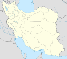
Description: Location map of Iran. Equirectangular projection. Strechted by 118.0%. Geographic limits of the map: * N: 40.0° N * S: 24.5° N * W: 43.5° E * E: 64.0° E Made with Natural Earth. Free vector and raster map data @ naturalearthdata.com.
Title: Iran location map
Credit: Own work
Author: Uwe Dedering
Usage Terms: Creative Commons Attribution-Share Alike 3.0
License: CC BY-SA 3.0
License Link: http://creativecommons.org/licenses/by-sa/3.0
Attribution Required?: Yes
Image usage
More than 100 pages link to this image. The following list shows the first 100 page links to this image only. A full list is available.
- Ab Anar, Marvdasht
- Ab Anar, Shiraz
- Ab Anarak
- Ab Anjir, Darab
- Abadan, Iran
- Abadeh
- Abadeh Tashk
- Adar, Iran
- Ahel
- Alamarvdasht
- Arad, Iran
- Ardabil
- Ardakan, Fars
- Armardeh
- Arsanjan
- Asir, Iran
- Bab Anar
- Bahman, Fars
- Baladeh, Fars
- Banaruiyeh
- Baneh County
- Barmas
- Bazargan
- Beyram, Iran
- Beyza
- Bishapur
- Buin-e Sofla
- Darab
- Darian, Iran
- Dehram
- Dowbaran
- Duzeh
- Efzar
- Eqlid
- Esfahān
- Eshkanan
- Estahban
- Evaz
- Farashband
- Fasa
- Firuzabad, Fars
- Fishvar
- Galleh Dar
- Gerash
- Hajjiabad, Fars
- Hamadan
- Hamashahr
- Ij, Iran
- Istakhr
- Jannat Shahr
- Juyom
- Kamfiruz
- Karzin
- Kavar
- Kazerun
- Kerman
- Kermanshah
- Kharameh
- Khavaran, Fars
- Khesht
- Khomein
- Khonj
- Khumeh Zar
- Khur, Fars
- Konartakhteh
- Korehi
- Kunani
- Lamerd
- Lapui
- Lar, Iran
- Latifi
- Marivan
- Marvdasht
- Masiri
- Meshkan
- Meymand
- Mohr, Fars
- Neyriz
- Nir, Iran
- Nowdan
- Nujin
- Nurabad, Fars
- Pasargadae
- Persepolis
- Qaderabad
- Qaemiyeh
- Qatruyeh
- Qir
- Qom
- Qotbabad
- Ramjerd
- Ramsar, Mazandaran
- Rasht
- Ray, Iran
- Runiz
- Saadat Shahr
- Safashahr
- Sarvestan
- Sedeh
- Semnan, Iran

All content from Kiddle encyclopedia articles (including the article images and facts) can be freely used under Attribution-ShareAlike license, unless stated otherwise.