
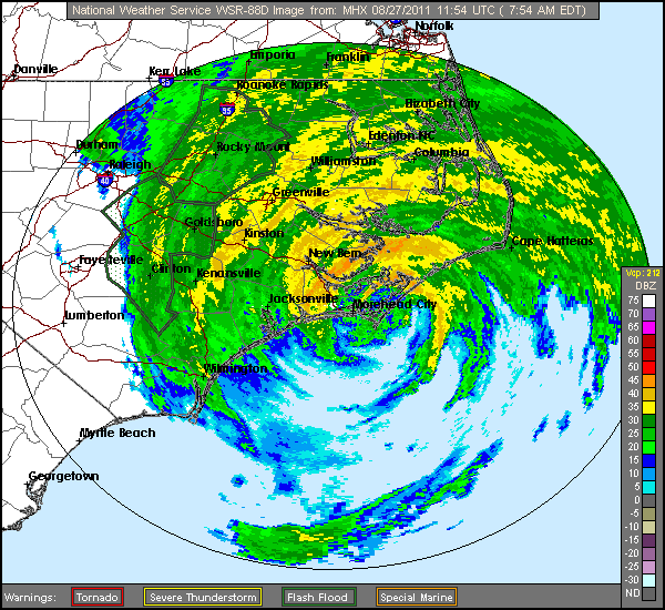
Image: Irene radar 20110827 1154 UTC
No higher resolution available.
Irene_radar_20110827_1154_UTC.gif (600 × 550 pixels, file size: 55 KB, MIME type: image/gif)
Description: At about 12Z Augst 27 (8am EDT), Irene made landfall near Cape Lookout, NC as a Cat 1 hurricane. The radar image from the approximate time of landfall is shown here.
Title: Irene radar 20110827 1154 UTC
Credit: http://bmcnoldy.blogspot.hk/2011/08/irene-makes-first-us-landfall-in-nc.html
Author: NWS Morehead City radar
Usage Terms: Public domain
License: Public domain
Attribution Required?: No
Image usage
The following page links to this image:

All content from Kiddle encyclopedia articles (including the article images and facts) can be freely used under Attribution-ShareAlike license, unless stated otherwise.