
Image: Is-wb-gs-gh v3
Size of this preview: 374 × 600 pixels. Other resolutions: 150 × 240 pixels | 1,428 × 2,289 pixels.
Original image (1,428 × 2,289 pixels, file size: 259 KB, MIME type: image/png)
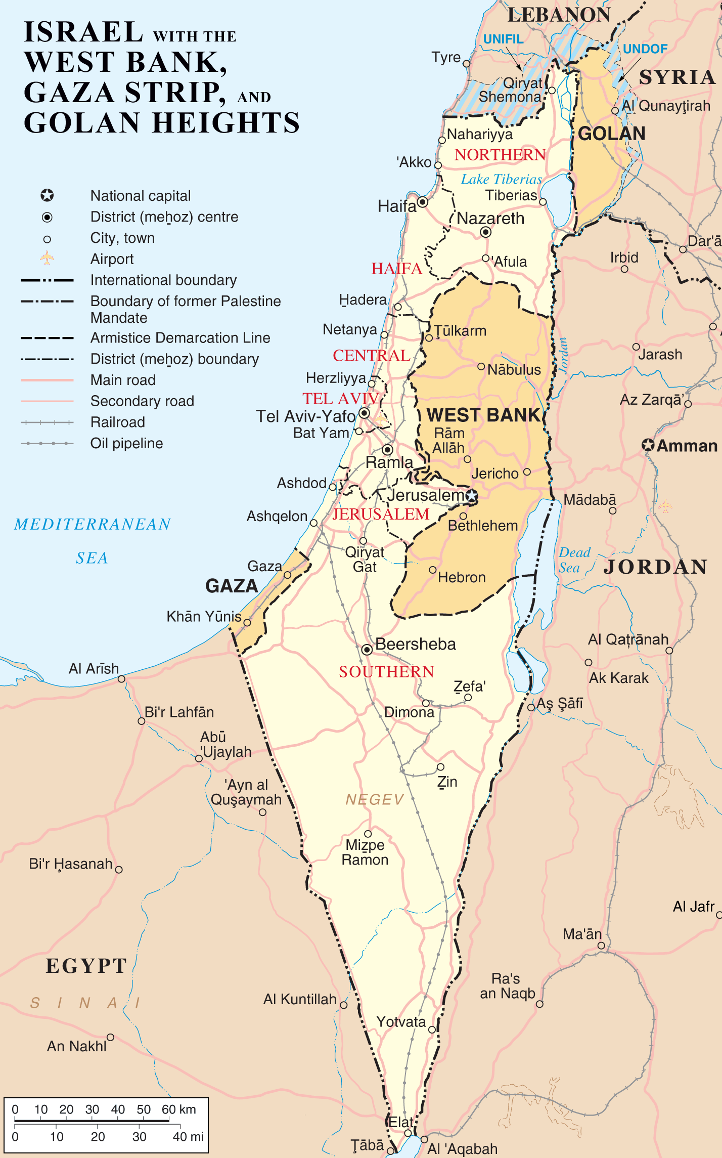
Description: Map of Israel, the Palestinian territories (West Bank and Gaza Strip), the Golan Heights, and portions of neighbouring countries. Also United Nations deployment areas in countries adjoining Israel or Israeli-held territory, as of January 2004.
Title: Is-wb-gs-gh v3
Credit: Transferred from en.wikipedia to Commons. (Original text: http://www.un.org/Depts/Cartographic/map/profile/israel.pdf (heavily modified))
Author: =The original uploader was ChrisO at English Wikipedia (Original text: en:User:ChrisO)
Usage Terms: Public domain
License: Public domain
Attribution Required?: No
Image usage
The following page links to this image:

All content from Kiddle encyclopedia articles (including the article images and facts) can be freely used under Attribution-ShareAlike license, unless stated otherwise.