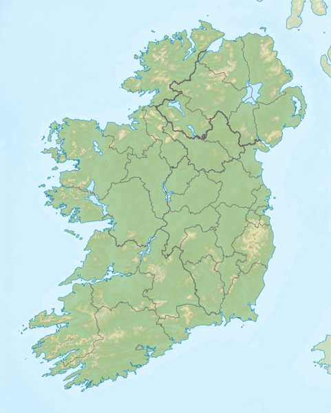
Image: Island of Ireland relief location map

Description: Relief map of Ireland Equirectangular map projection on WGS 84 datum, with N/S stretched 170% Geographic limits: West: 11.0° W East: 5.0° W North: 55.6° N South: 51.2° N
Title: Island of Ireland relief location map
Credit: Shuttle Radar Topography Mission Relief data National Geospatial-Intelligence Agency Coastline data File:Island of Ireland location map.svg: Rannpháirtí anaithnid Borders
Author: Nilfanion
Permission: This file is licensed under the Creative Commons Attribution-Share Alike 3.0 Unported license. You are free: to share – to copy, distribute and transmit the work to remix – to adapt the work Under the following conditions: attribution – You must attribute the work in the manner specified by the author or licensor (but not in any way that suggests that they endorse you or your use of the work). share alike – If you alter, transform, or build upon this work, you may distribute the resulting work only under the same or similar license to this one. http://creativecommons.org/licenses/by-sa/3.0 CC BY-SA 3.0 Creative Commons Attribution-Share Alike 3.0 truetrue
Usage Terms: Creative Commons Attribution-Share Alike 3.0
License: CC BY-SA 3.0
License Link: http://creativecommons.org/licenses/by-sa/3.0
Attribution Required?: Yes
Image usage
More than 100 pages link to this image. The following list shows the first 100 page links to this image only. A full list is available.
- Annagh Hill
- Annaghmore Lough
- Ardderry Lough
- Aughrusbeg Lough
- Ballycuirke Lough
- Ballynahinch Lake
- Ballynakill Lough
- Barcam
- Bargy Castle
- Barnaslingan
- Barrclashcame
- Baunreaghcong
- Baurtregaum
- Beenkeragh
- Beenoskee
- Belhavel Lough
- Benbaun
- Benbradagh
- Binn Chaonaigh
- Binn Mhór
- Binn idir an dá Log
- Black Rock Mountain, County Wexford
- Blacksod Bay
- Blackstairs Mountain
- Brandon Hill
- Broadhaven Bay
- Caher Mountain (Cork)
- Caherconree
- Camaderry
- Camenabologue
- Caragh Lake
- Carhoo Hill
- Carn Clonhugh
- Carrickaport lough
- Carrickgollogan
- Carrigvore
- Castleconor
- Castlefore Lough
- Cavetown Lough
- Church Mountain
- Clermont Carn
- Cloghernagh
- Clonycavan Man
- Cloonacleigha Lough
- Cloonagh Lough (Roscommon)
- Cloonaghlin Lough
- Cnoc an Chuillinn
- Cnoc na Toinne
- Conavalla
- Coomacarrea
- Coomsaharn char
- Coppanagh
- Corcogemore
- Corrigasleggaun
- Croaghanmoira
- Croaghgorm
- Crocknalaragagh
- Croghan Hill
- Croghan Mountain
- Cross Lough
- Croughaun Hill
- Cruach Mhór
- Derryclare Lough
- Djouce
- Doo Lough (Clare)
- Doo Lough (Mayo)
- Dromore Lough (Clare)
- Drumaleague Lough
- Duff Hill
- Dunglow Lough
- Dunlewey Lough
- Durnesh Lough
- Easky Lough
- Errit Lough
- Fauscoum
- Galtymore
- Garadice Lough
- Garraun (Galway)
- Gartan Lough
- Geokaun
- Glanmore Lake
- Glenade Lough
- Glenbeg Lough
- Hag's Tooth, Kerry
- Hill of Tara
- Lough MacNean
- Lough Melvin
- Lugnaquilla
- MacGillycuddy's Reeks
- Malone Golf Club
- Maolán Buí
- Montpelier Hill
- Mount Brandon
- Mourne Mountains
- RMS Lusitania
- Sawel Mountain
- Slieve Donard
- Slieve Gullion
- The Big Gun
- The Bones

