
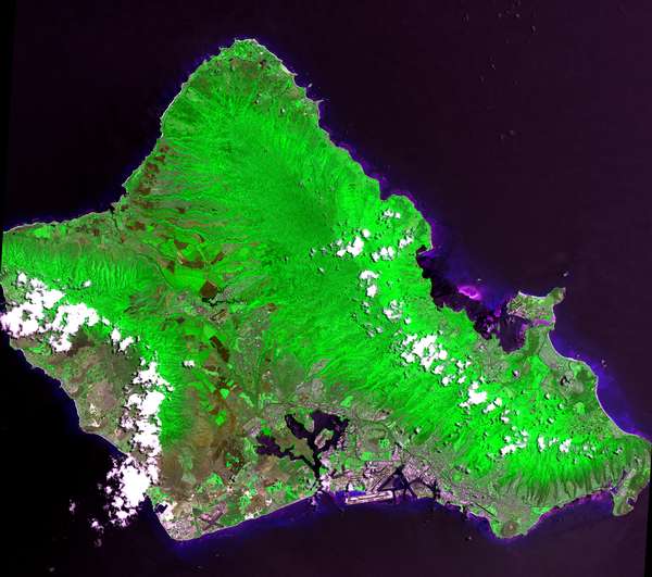
Image: Island of Oahu - Landsat mosaic
No higher resolution available.
Island_of_Oahu_-_Landsat_mosaic.jpg (600 × 531 pixels, file size: 42 KB, MIME type: image/jpeg)
Description: This 60 by 50 kilometer (37 by 31 mile) scene from the Advanced Spaceborne Thermal Emission and Reflection Radiometer (ASTER) instrument on NASA's Terra satellite shows almost the entire island of Oahu, Hawaii, on June 3, 2000.
Title: Island of Oahu - Landsat mosaic
Credit: Image and its description.
Author: Hawaii Land Cover Analysis project, NOAA Coastal Services Center
Permission: Public domain - original work of NASA and NOAA
Usage Terms: Public domain
License: PD
Attribution Required?: No
Image usage
The following page links to this image:

All content from Kiddle encyclopedia articles (including the article images and facts) can be freely used under Attribution-ShareAlike license, unless stated otherwise.