
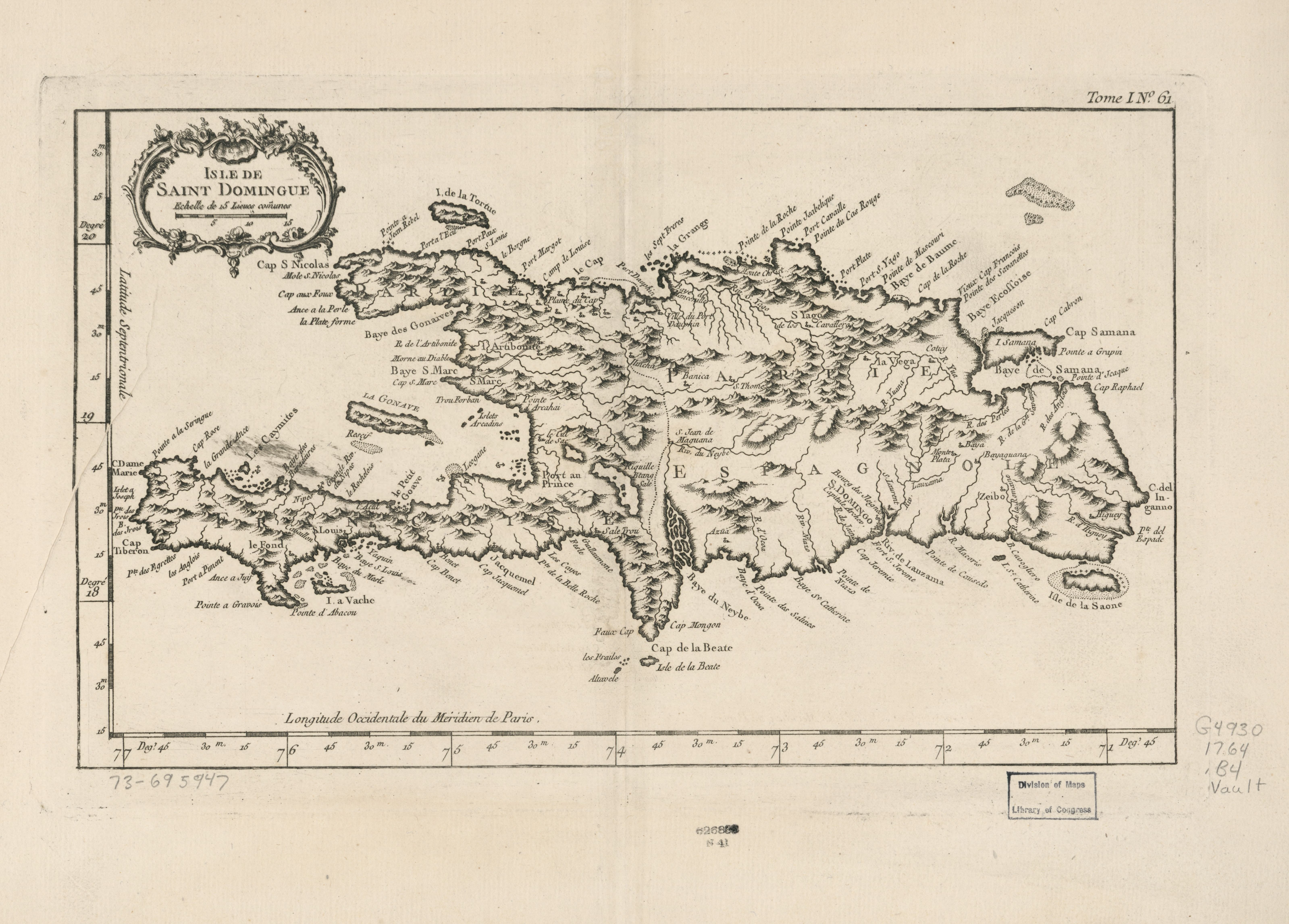
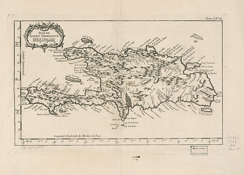
Image: Isle de Saint Domingue. LOC 73695947
Size of this preview: 800 × 574 pixels. Other resolutions: 320 × 230 pixels | 6,396 × 4,589 pixels.
Original image (6,396 × 4,589 pixels, file size: 3.04 MB, MIME type: image/jpeg)
Description: Scale ca. 1:1,750,000. Relief shown pictorially. LC Maps of North America, 1750-1789, 1854 Available also through the Library of Congress Web site as a raster image. "Longitude occidentale du méridien de Paris." "Tome I, no. 61." From the author's Le petit atlas maritime. 1764. Vault AACR2: 100
Usage Terms: Public domain
Image usage
The following page links to this image:

All content from Kiddle encyclopedia articles (including the article images and facts) can be freely used under Attribution-ShareAlike license, unless stated otherwise.