
Image: Isle of Anglesey UK location map

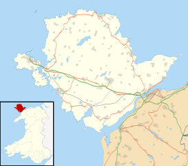
Description: Blank map of the Anglesey, UK with the following information shown: Administrative borders Coastline, lakes and rivers Roads and railways Urban areas Equirectangular map projection on WGS 84 datum, with N/S stretched 165% Geographic limits: West: 4.75W East: 4.00W North: 53.45N South: 53.05N
Title: Isle of Anglesey UK location map
Credit: Ordnance Survey OpenData. Administrative borders and coastline data from Boundary-Line product. All other geographic data from Meridian 2 product. Inset derived from File: United Kingdom location map.svg by NordNordWest.
Author: Nilfanion, created using Ordnance Survey data
Permission: This file is licensed under the Creative Commons Attribution-Share Alike 3.0 Unported license. Attribution: Contains Ordnance Survey data © Crown copyright and database right You are free: to share – to copy, distribute and transmit the work to remix – to adapt the work Under the following conditions: attribution – You must attribute the work in the manner specified by the author or licensor (but not in any way that suggests that they endorse you or your use of the work). share alike – If you alter, transform, or build upon this work, you may distribute the resulting work only under the same or similar license to this one. http://creativecommons.org/licenses/by-sa/3.0 CC BY-SA 3.0 Creative Commons Attribution-Share Alike 3.0 truetrue
Usage Terms: Creative Commons Attribution-Share Alike 3.0
License: CC BY-SA 3.0
License Link: http://creativecommons.org/licenses/by-sa/3.0
Attribution Required?: Yes
Image usage
The following 25 pages link to this image:
- Amlwch
- Anglesey
- Benllech
- Bryn Gwyn stones
- Caer Gybi (fort)
- Cribinau
- Cymyran Strait
- Dwynwen
- Elim, Anglesey
- Hermon, Anglesey
- Holyhead
- Llanfaes Friary
- Llanfair-yng-Nghornwy
- Llanfairpwllgwyngyll
- Llanfechell
- Melin Adda, Amlwch
- Moelfre, Anglesey
- North Stack
- Old Church of St Nidan, Llanidan
- Penmon
- Porth Dafarch
- South Stack
- St Cynfarwy's Church, Llechgynfarwy
- Tŷ Newydd Burial Chamber
- Template:Location map Wales Anglesey
