
Image: Israel location map with stripes

Size of this PNG preview of this SVG file: 322 × 598 pixels. Other resolution: 129 × 240 pixels.
Original image (SVG file, nominally 614 × 1,141 pixels, file size: 170 KB)
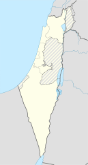
Description: English (en): The 1949 armistice line, aka the "Green Line" or "pre-67 borders" Borders of the Israeli-annexed East Jerusalem and Golan Heights Non-Israeli borders
Title: Israel location map with stripes
Credit: This file was derived from: Israel location map.svg
Author: Israel location map.svg: NordNordWest (talk) derivative work: Jackmcbarn (talk)
Permission: You may select the license of your choice.
Usage Terms: Creative Commons Attribution-Share Alike 3.0
License: CC BY-SA 3.0
License Link: https://creativecommons.org/licenses/by-sa/3.0
Attribution Required?: Yes
Image usage
The following 10 pages link to this image:

All content from Kiddle encyclopedia articles (including the article images and facts) can be freely used under Attribution-ShareAlike license, unless stated otherwise.