
Image: John Smith 1624 map of Bermuda with Forts 01
Size of this preview: 766 × 600 pixels. Other resolutions: 307 × 240 pixels | 1,370 × 1,073 pixels.
Original image (1,370 × 1,073 pixels, file size: 1.39 MB, MIME type: image/jpeg)
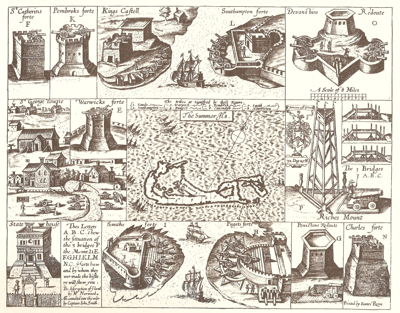
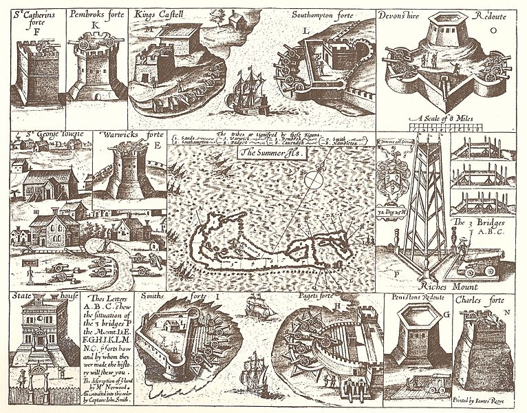
Description: 1624 Map of Bermuda, with illustrations of fortifications and importand sites, including St. George's, Bermuda (the town), the State House, Bermuda, and the Castle Islands Fortifications, Bermuda
Title: John Smith 1624 map of Bermuda with Forts 01
Credit: The Generall Historie of Virginia, New-England, and the Summer Isles, by Captain John Smith of Jamestown, printed by I.D and I. H. for Michael Sparkes, 1624. Other editions 1625, 1626, 1627, 1631, and 1632.
Author: Printed by James Reeve
Usage Terms: Public domain
License: Public domain
Attribution Required?: No
Image usage
The following 19 pages link to this image:
- Bermuda Garrison
- Bermuda Militia 1612–1687
- Bermuda Militias 1612–1815
- Castle Islands Fortifications, Bermuda
- Church of England
- English overseas possessions in the Wars of the Three Kingdoms
- Fortification
- Fortress
- Historic Town of St George and Related Fortifications, Bermuda
- History of Bermuda
- John Smith (explorer)
- List of World Heritage Sites in the United Kingdom
- Military of Bermuda
- Militia
- Militia (British Dominions and Crown Colonies)
- Militia (England)
- Robert Rich, 2nd Earl of Warwick
- Sea Venture
- State House, Bermuda

All content from Kiddle encyclopedia articles (including the article images and facts) can be freely used under Attribution-ShareAlike license, unless stated otherwise.