
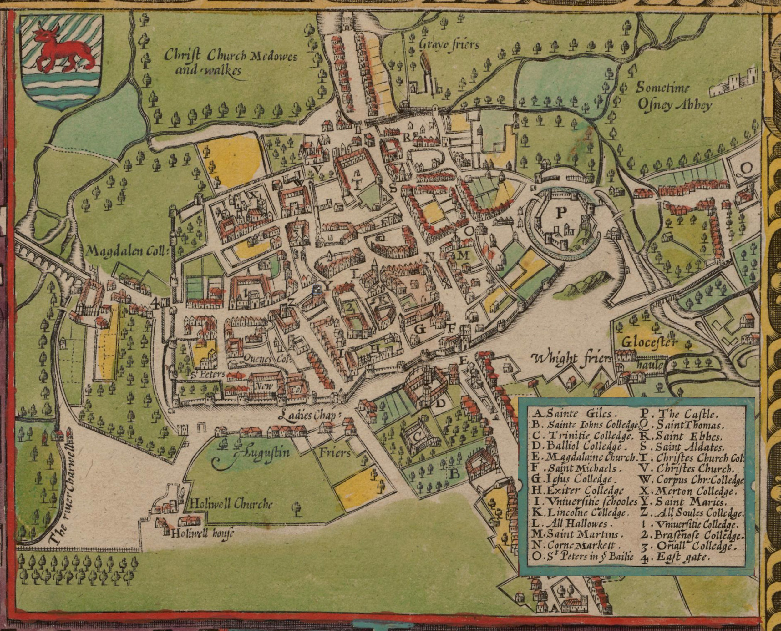
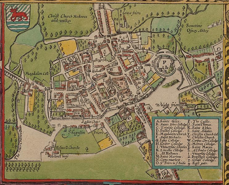
Image: John Speed's map of Oxford, 1605.
Description: John Speed's map of Oxford, 1605. North is at the bottom. Oxford is still a walled city, but there some buildings are outside the walls, including Magdalen College. "P" is Oxford Castle "N" is Oxford's central crossroads at the junction of the High Street and St Aldates. Broad Street and Holywell Street now run along the line of the north (that is bottom) wall.
Title: John Speed's map of Oxford, 1605.
Credit: The Digital Revolution: Changing Oxford. Map is in the Bodleian Library.
Author: John Speed (1542–1629)
Permission: This work is in the public domain in its country of origin and other countries and areas where the copyright term is the author's life plus 100 years or less. You must also include a United States public domain tag to indicate why this work is in the public domain in the United States. This file has been identified as being free of known restrictions under copyright law, including all related and neighboring rights. This work is in the public domain in its country of origin and other countries and areas where the copyright term is the author's life plus 100 years or less. You must also include a United States public domain tag to indicate why this work is in the public domain in the United States. This file has been identified as being free of known restrictions under copyright law, including all related and neighboring rights.
Usage Terms: Public domain
License: Public domain
Attribution Required?: No
Image usage
The following 3 pages link to this image:
