
Image: Journal of the Royal Society of Antiquaries of Ireland (1915) (14593898110)
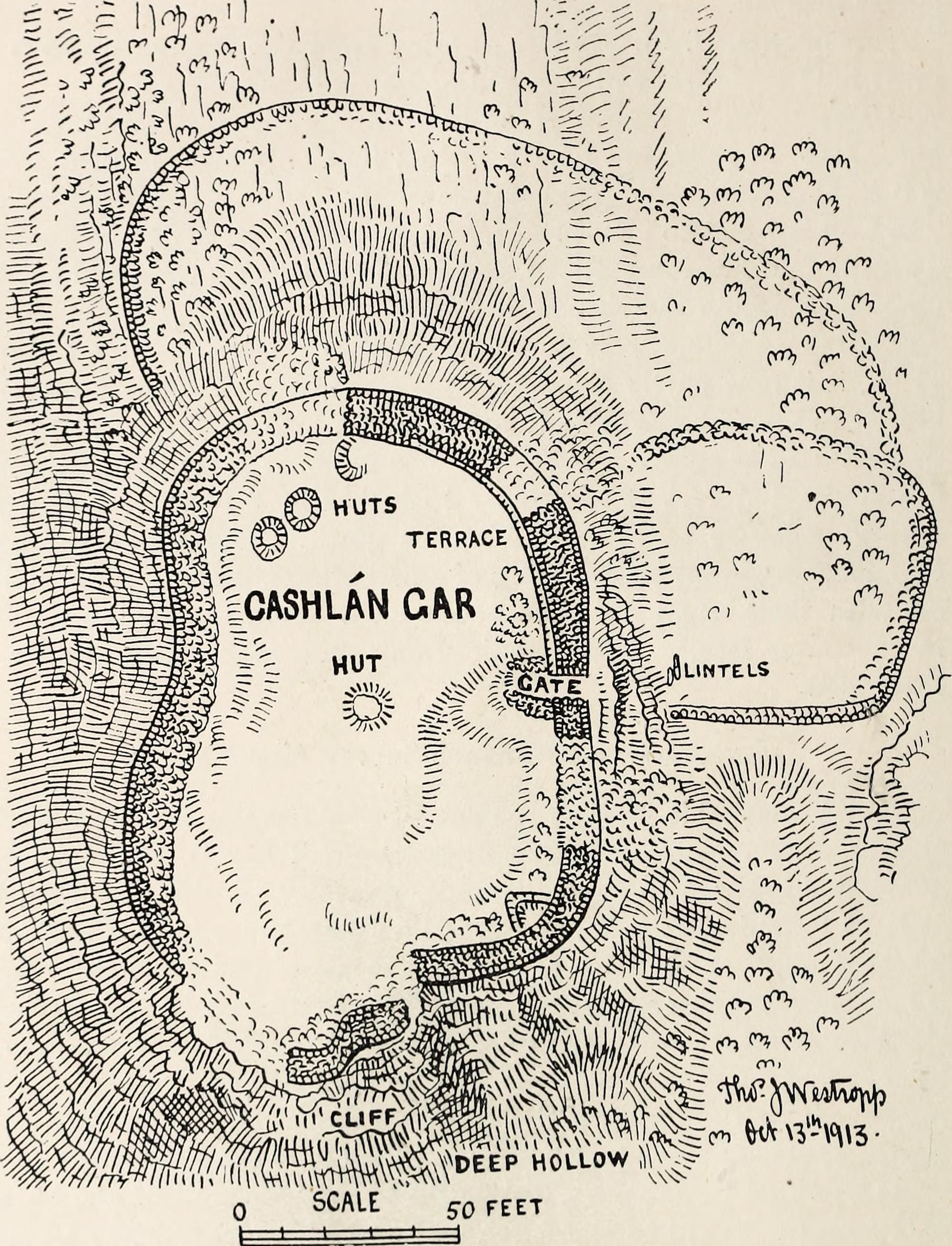
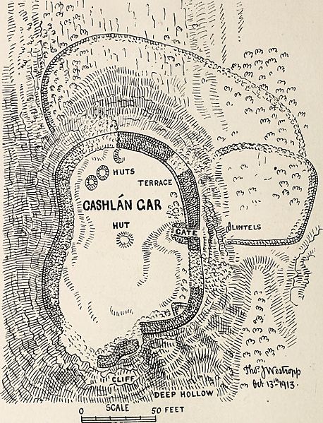
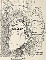
Description: Identifier: journalofroyalso45roya (find matches) Title: Journal of the Royal Society of Antiquaries of Ireland Year: 1915 (1910s) Authors: Royal Society of Antiquaries of Ireland Royal Society of Antiquaries of Ireland. Transactions Royal Society of Antiquaries of Ireland. Proceedings and transactions Royal Society of Antiquaries of Ireland. Proceedings and papers Subjects: Publisher: Dublin, Ireland : The Society Contributing Library: Allen County Public Library Genealogy Center Digitizing Sponsor: Internet Archive View Book Page: Book Viewer About This Book: Catalog Entry View All Images: All Images From Book Click here to view book online to see this illustration in context in a browseable online version of this book. Text Appearing Before Image: le to givea revised plan showing the outer enclosures, which are hard tomeasure, being covered with bushes. The huts are so covered withgrass as to be now hardly distinguishable. The wall of the outerenclosure (or bawn) to the north and east of the rock is, as a rule,6 feet thick, of large blocks, usually 5 to 6 feet, one 8 feet 3 incheslong and 2 to 3 feet high and thick. It is 61 feet from the innerfort to the north, running to what may be an older loop to the east,which turns back to the foot of the rock in line with the south jamb 1 I only know of this style of building elsewhere in a curious ring-wall atCarrahan in eastern Co. Clare. See Proc. R. I. Acad., vol. xxxii, p. 73. 2 Journal, vol. xxvi, p. 152 ; vol. xxix, p. 383 ; vol. xliii, p. 254. 270 ROYAL SOCIETY OF ANTIQUARIES OF IRELAND of the gateway, being there 63 feet out from the citadel wall. Themain wall is 6 feet 2 inches thick, the terrace 2 feet 6 inchesmore; the whole in parts 10 feet, and at the gate 11 feet 6 inches Text Appearing After Image: thick and 8 feet high. It is 3 feet higher than the terrace and 12feet 6 inches high outside. Templemore-Kells (Ordnance Survey Map 17). In my former visits in 1894 and 1898 I failed to recognise in thehedge of hawthorns, brambles and modern walls round the church PREHISTORIC REMAINS IN BURREN 271 anything notable or ancient. The new maps, showing a circularfence, led me to revisit it, and I am able to add a plan of anothertypical example of a church in a ring-wall, like Glencolumbcille. The ruin1 is situated in a pleasing position, among rich fields,near a lake, with a view of the flank and cliffs of the GlasgeivnaghHill and Slievenaglasha, and Mullach, with its great rock terracesand grey dome. The approach is by an old lane way to the north- Note About Images Please note that these images are extracted from scanned page images that may have been digitally enhanced for readability - coloration and appearance of these illustrations may not perfectly resemble the original work.
Title: Journal of the Royal Society of Antiquaries of Ireland (1915) (14593898110)
Credit: https://www.flickr.com/photos/internetarchivebookimages/14593898110/ Source book page: https://archive.org/stream/journalofroyalso45roya/journalofroyalso45roya#page/n347/mode/1up
Author: Internet Archive Book Images
Permission: At the time of upload, the image license was automatically confirmed using the Flickr API. For more information see Flickr API detail.
Usage Terms: No known copyright restrictions
License: No restrictions
License Link: https://www.flickr.com/commons/usage/
Attribution Required?: No
Image usage
The following 4 pages link to this image:

_(14593898110).jpg)