
Image: Kankakee aerial

Size of this preview: 800 × 533 pixels. Other resolutions: 320 × 213 pixels | 4,368 × 2,912 pixels.
Original image (4,368 × 2,912 pixels, file size: 5.27 MB, MIME type: image/jpeg)
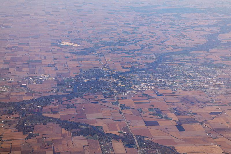
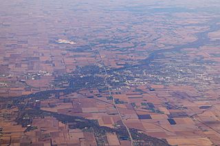
Description: Aerial photo of Kankakee, Illinois (looking westward). The confluence of Iroquois River and Kankakee River is visible on the left edge of the frame. Interstate 57 is running from right to left (north-south) through the image, the four lane road in east-west direction is Illinois Route 17.
Title: Kankakee aerial
Credit: Own work
Author: Daniel Schwen
Usage Terms: Creative Commons Attribution-Share Alike 4.0
License: CC BY-SA 4.0
License Link: http://creativecommons.org/licenses/by-sa/4.0
Attribution Required?: Yes
Image usage
The following page links to this image:

All content from Kiddle encyclopedia articles (including the article images and facts) can be freely used under Attribution-ShareAlike license, unless stated otherwise.