
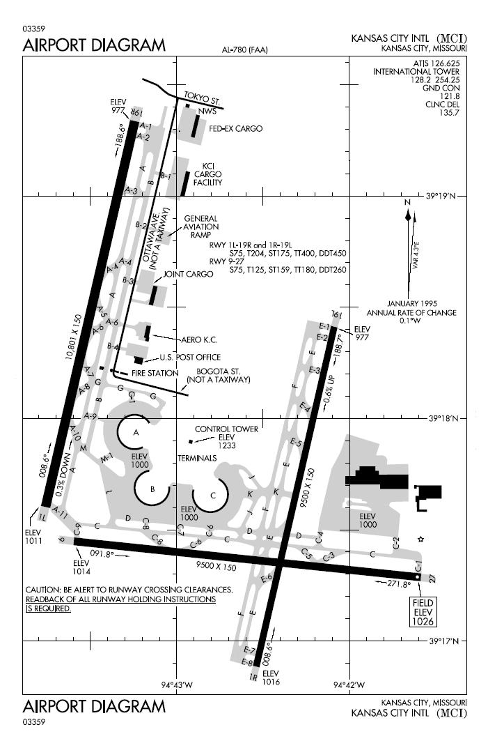
Image: Kansas City International Airport Map
Size of this preview: 390 × 599 pixels. Other resolutions: 156 × 240 pixels | 701 × 1,076 pixels.
Original image (701 × 1,076 pixels, file size: 104 KB, MIME type: image/jpeg)
Description: FAA diagram for Kansas City International Airport (MCI) in Kansas City, Missouri, United States. Warning: this diagram contains material which is subject to change, do not use for navigation.
Title: Kansas City International Airport Map
Credit: http://naco.faa.gov/d-tpp/0512/00780AD.PDF Note: this URL changes monthly; the airport article should contain a link to the current FAA diagram.
Author: National Aeronautical Charting Office (NACO), a department of the en:Federal Aviation Administration (FAA)
Usage Terms: Public domain
License: Public domain
Attribution Required?: No
Image usage
The following page links to this image:

All content from Kiddle encyclopedia articles (including the article images and facts) can be freely used under Attribution-ShareAlike license, unless stated otherwise.