
Image: Karl Theodor lands c. 1780
No higher resolution available.
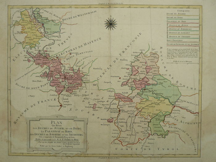
Karl_Theodor_lands_c._1780.jpg (700 × 525 pixels, file size: 73 KB, MIME type: image/jpeg)
Description: Map from c. 1780 showing the various territories rules by Elector Karl Theodor at the time. The French-language map is titled Plan qui réuni les duchés de Juliers et de Berg, le Palatinat du Rhin, les duchés de Bavière et de Neubourg. The map was dedicated to and presented to S.A.S.E. Palatin du Rhin (Karl Theodor). Published in Augsburg by the Lotter brothers.
Title: Karl Theodor lands c. 1780
Credit: Antique map seller
Author: Lotter Brothers, c. 1780
Usage Terms: Public domain
License: Public domain
Attribution Required?: No
Image usage
There are no pages that link to this image.

All content from Kiddle encyclopedia articles (including the article images and facts) can be freely used under Attribution-ShareAlike license, unless stated otherwise.