
Image: Kennington Underground station map, 1893
Size of this preview: 800 × 580 pixels. Other resolutions: 320 × 232 pixels | 829 × 601 pixels.
Original image (829 × 601 pixels, file size: 502 KB, MIME type: image/jpeg)
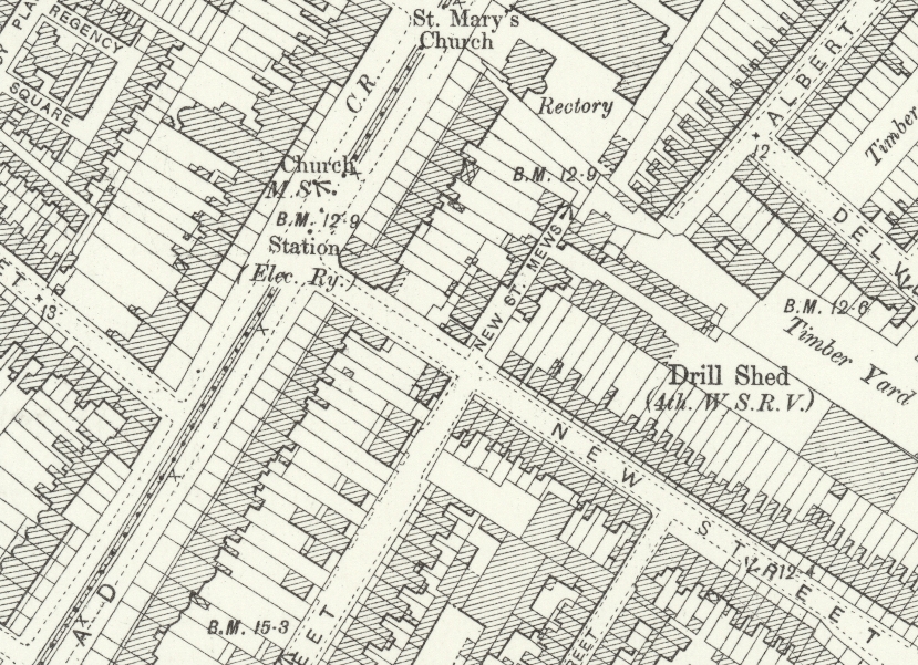
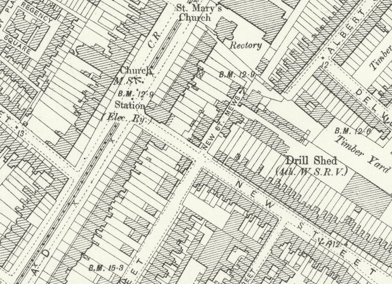
Description: Kennington tube station at the junction of Kennington Park Road and New Street (now Braganza Street) in Southwark on an Ordnance Survey Map.
Title: Kennington Underground station map, 1893
Credit: Ordnance Survey map: London LXXXIX
Author: Unknown author
Usage Terms: Public domain
License: Public domain
Attribution Required?: No
Image usage
The following page links to this image:

All content from Kiddle encyclopedia articles (including the article images and facts) can be freely used under Attribution-ShareAlike license, unless stated otherwise.