
Image: Kent Island, MD
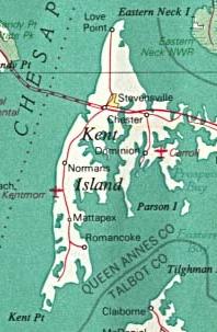
Description: A map of Kent Island from 1970
Title: Kent Island, MD
Credit: This image was cropped from a 1970 map of the Baltimore-Washington Metropolitan Area found at http://www.lib.utexas.edu/maps/world_cities/washington_baltimore.jpg At http://www.lib.utexas.edu/usage_statement.html?maps=yes the website says "most of the maps in the PCL Map Collection" are in the public domain and this particular map is in the PCL collection indexed at http://www.lib.utexas.edu/maps/world_cities.html where it says "The following maps were produced by U.S. Government agencies as noted" and it notes "U.S. National Atlas, 1970" for this particular map. The atlas was published by USGS, a US government agency.
Permission: The source image is in the public domain.
Usage Terms: Public domain
License: PD
Attribution Required?: No
Image usage
The following page links to this image:
