
Image: Kent Railways

Size of this PNG preview of this SVG file: 800 × 525 pixels. Other resolution: 320 × 210 pixels.
Original image (SVG file, nominally 1,839 × 1,207 pixels, file size: 125 KB)
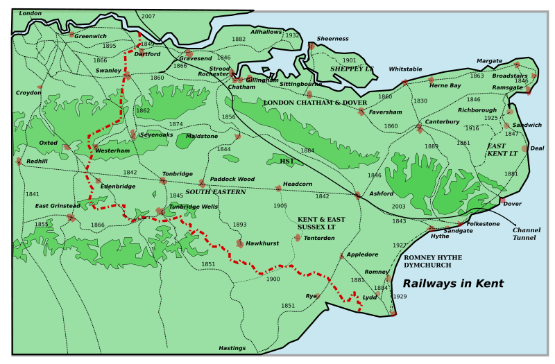
Description: A map of all the railways in Kent, giving their name and date of construction. Inspired by Jessop, Kent History Illustrated, with addition of HS1 in 2003 and 2007. Please inform me of errors and omissions via my Talk page. Constructed using Inkscape, so there may be rendering problems.
Title: Kent Railways
Credit: Own work
Author: Clem Rutter, Rochester, Kent.
Usage Terms: Creative Commons Attribution 2.5
License: CC BY 2.5
License Link: http://creativecommons.org/licenses/by/2.5
Attribution Required?: Yes
Image usage
The following 4 pages link to this image:

All content from Kiddle encyclopedia articles (including the article images and facts) can be freely used under Attribution-ShareAlike license, unless stated otherwise.