
Image: Kilauea gps-pp1801 1-13

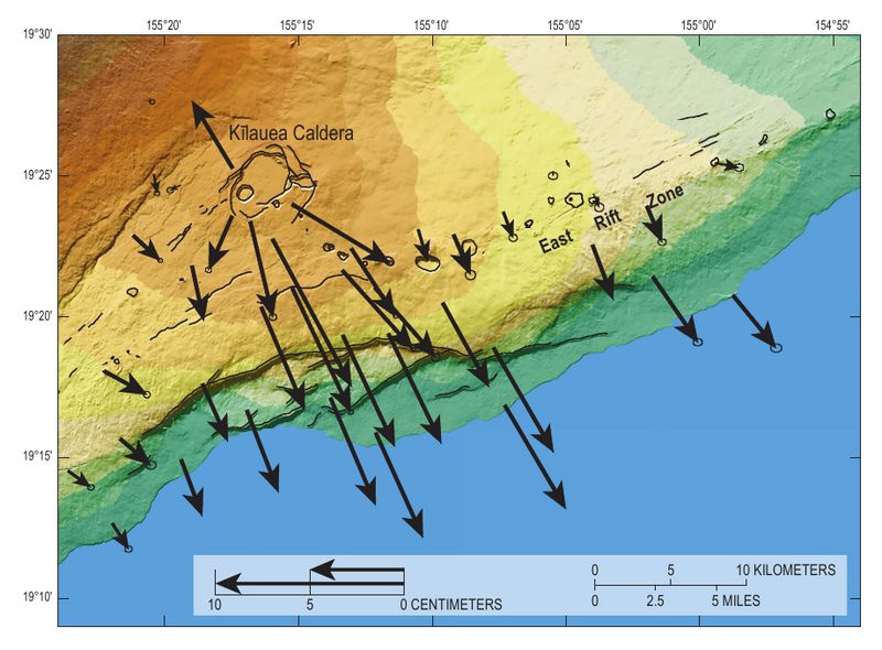
Description: Figure 13 from USGS Professional Paper 1801, Chapter 1, p. 21. Map of the south flank of Kīlauea with vectors showing horizontal displacements in 2003 through 2006 above the Hilina slump, relative to other stations on the island of Hawaii. Measured by the Hawaii Volcano Observatory using the Global Positioning System.
Title: Kilauea gps-pp1801 1-13
Credit: https://pubs.usgs.gov/pp/1801/downloads/pp1801_Chap1_Tilling.pdf
Author: Image by Michael Poland and Asta Miklius, U.S. Geological Survey
Permission: This image is in the public domain in the United States because it only contains materials that originally came from the United States Geological Survey, an agency of the United States Department of the Interior. For more information, see the official USGS copyright policy.
Usage Terms: Public domain
License: Public domain
Attribution Required?: No
Image usage
The following page links to this image:
