
Image: Kingdom of Mann and the Isles-en

Size of this PNG preview of this SVG file: 571 × 600 pixels. Other resolution: 229 × 240 pixels.
Original image (SVG file, nominally 1,297 × 1,362 pixels, file size: 209 KB)
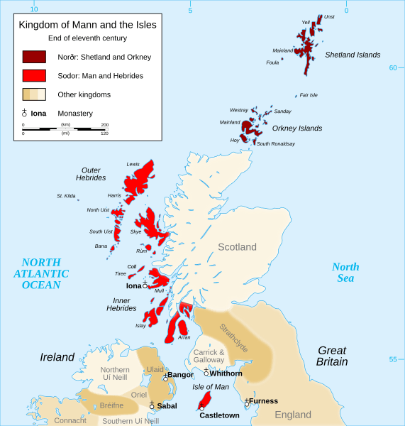
Description: English: Map of the kingdom of Mann and the Isles, nearly the end of eleventh century. Norðr: Shetland and Orkney Sodor: Man and Hebrides
Title: Kingdom of Mann and the Isles-en
Credit: English: Own work, from: Map of British Isles Map of kingdoms of Scotland in the Middle Ages Map of kingdoms of Ireland nearly 1014 Map of the diocese of Sodor and Mann
Author: Sémhur
Usage Terms: Creative Commons Attribution-Share Alike 3.0
License: CC BY-SA 3.0
License Link: http://creativecommons.org/licenses/by-sa/3.0
Attribution Required?: Yes
Image usage

All content from Kiddle encyclopedia articles (including the article images and facts) can be freely used under Attribution-ShareAlike license, unless stated otherwise.