
Image: Kingdoms around Israel 830 map

Size of this PNG preview of this SVG file: 502 × 599 pixels. Other resolution: 201 × 240 pixels.
Original image (SVG file, nominally 720 × 859 pixels, file size: 165 KB)
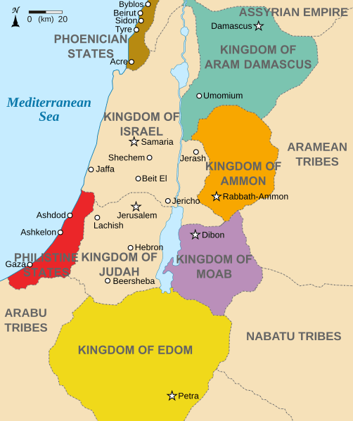
Description: Map showing states around Israel and Judah. The Kingdoms around Israel and Judah are colored: Phoenicia -Brown Aram Damascus - Aquamarine Amon - Orange Moab - Purple Edom - Yellow Philistia - Red The map shows the region in the 9th century BCE.
Title: Kingdoms around Israel 830 map
Credit: Kingdoms_of_Israel_and_Judah_map_830.svg
Author: Kingdoms_of_Israel_and_Judah_map_830.svg: *Oldtidens_Israel_&_Judea.svg: FinnWikiNo derivative work: Richardprins (talk) derivative work: Richardprins (talk)
Usage Terms: Creative Commons Attribution-Share Alike 3.0
License: CC BY-SA 3.0
License Link: http://creativecommons.org/licenses/by-sa/3.0
Attribution Required?: Yes
Image usage

All content from Kiddle encyclopedia articles (including the article images and facts) can be freely used under Attribution-ShareAlike license, unless stated otherwise.