
Image: Kingdoms of Israel and Judah map 830

Size of this PNG preview of this SVG file: 502 × 599 pixels. Other resolution: 201 × 240 pixels.
Original image (SVG file, nominally 720 × 859 pixels, file size: 78 KB)
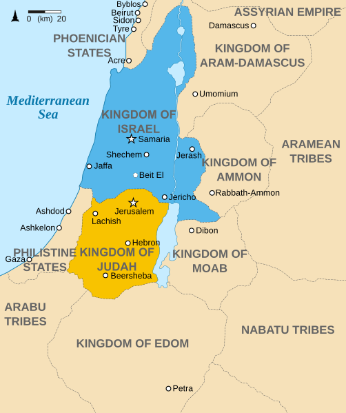
Description: Map showing the Kingdoms of Israel (blue) and Judah (orange), ancient Southern Levant borders and ancient cities such as Urmomium and Jerash. The map shows the region in the 9th century BCE.
Title: Kingdoms of Israel and Judah map 830
Credit: Oldtidens_Israel_&_Judea.svg
Author: Oldtidens_Israel_&_Judea.svg: FinnWikiNo derivative work: Richardprins (talk)
Usage Terms: Creative Commons Attribution-Share Alike 3.0
License: CC BY-SA 3.0
License Link: http://creativecommons.org/licenses/by-sa/3.0
Attribution Required?: Yes
Image usage
The following 5 pages link to this image:

All content from Kiddle encyclopedia articles (including the article images and facts) can be freely used under Attribution-ShareAlike license, unless stated otherwise.