
Image: Klawatti Glacier USGS
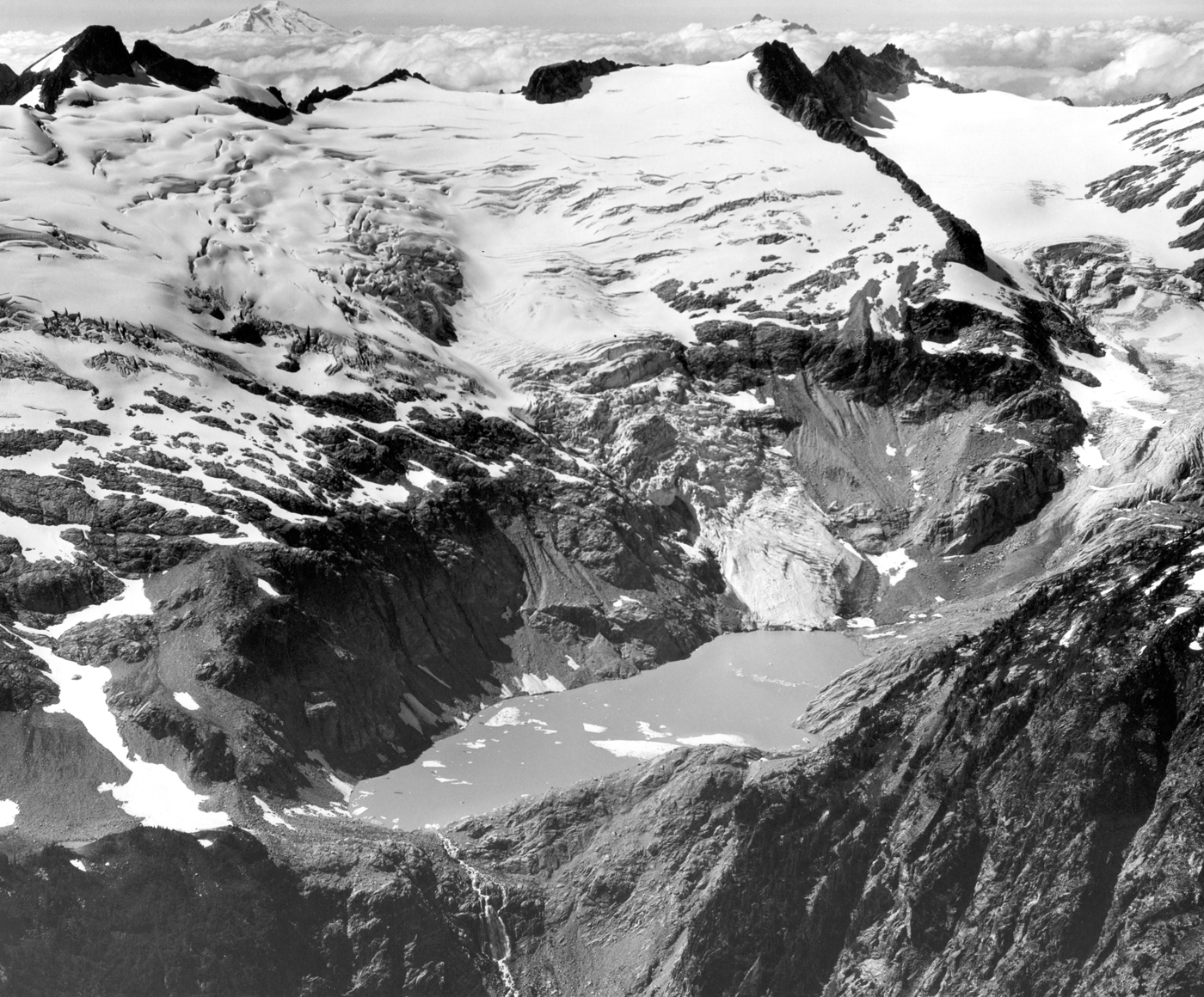
Description: North Cascades National Park, Washington. Klawatti (center) and North Klawatti (right) Glaciers, north of Eldorado Peak. These glaciers have exhibited striking and diverse changes in recent years although they are closely adjacent. In 1947, stagnant ice from both glaciers covered the area of Klawatti Lake. At that time Klawatti Glacier ended on the steep cliff which it now descends in a spectacular icefall. Since 1947, the ice in the basin has melted. The lake, now 1 kilometer in length, has formed, and the Klawatti Glacier has advanced down the cliff. Meanwhile the lower part of North Klawatti Glacier has continued to thin. August 2, 1969. Plate 3-B, U.S. Geological Survey Professional paper 705-A. 1971. Image file: http://libraryphoto.cr.usgs.gov/htmllib/batch88/batch88j/batch88z/post0002.jpg
Title: Klawatti Glacier USGS
Credit: U.S. Geological Survey Photographic Library
Author: Austin S. Post
Usage Terms: Public domain
License: Public domain
Attribution Required?: No
Image usage
The following 3 pages link to this image:
