
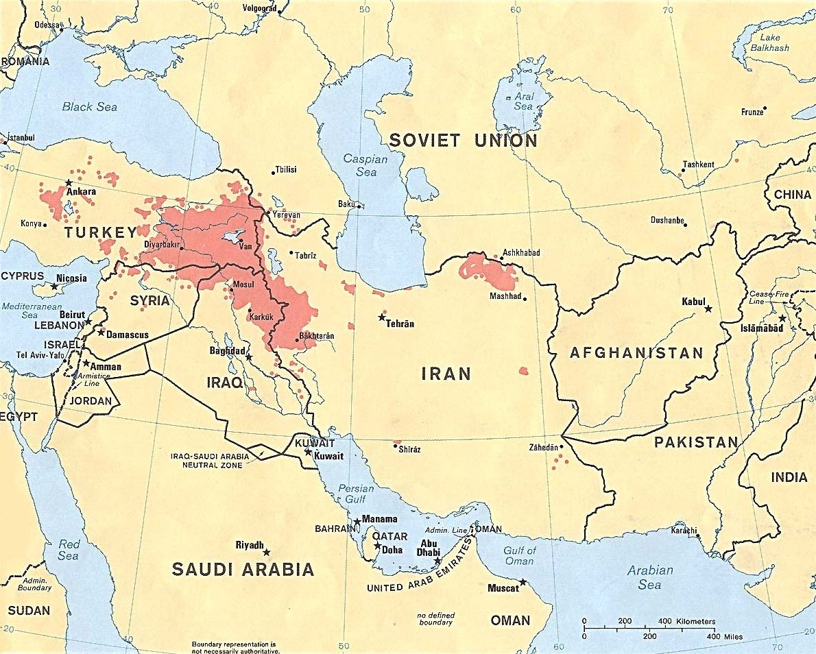
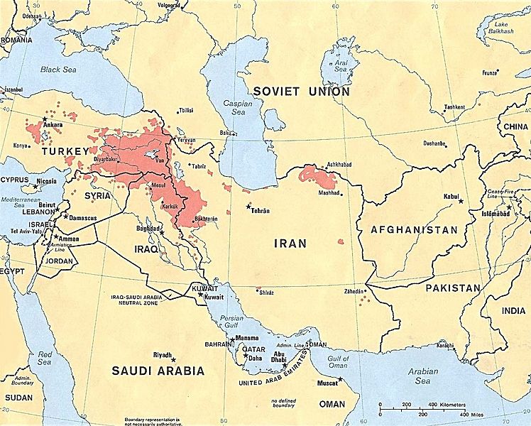
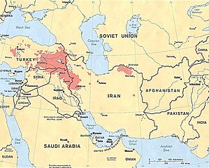
Image: Kurdish-inhabited areas of the Middle East and the Soviet Union in 1986
Size of this preview: 748 × 600 pixels. Other resolutions: 299 × 240 pixels | 1,190 × 954 pixels.
Original image (1,190 × 954 pixels, file size: 288 KB, MIME type: image/jpeg)
Description: Kurdish-inhabited areas of the Middle East and the Soviet Union in 1986
Title: Kurdish-inhabited areas of the Middle East and the Soviet Union in 1986
Credit: 800603 (544643) 3-86
Author: U.S. Central Intelligence Agency
Permission: See the list of maps at http://www.lib.utexas.edu/maps/iraq.html for a link to this map and related maps. That page says: "The following maps were produced by the U.S. Central Intelligence Agency, unless otherwise indicated." This particular map is labeled there as "Kurdish Areas in the Middle East and the Soviet Union. 1986."
Usage Terms: Public domain
License: Public domain
Attribution Required?: No
Image usage
The following page links to this image:

All content from Kiddle encyclopedia articles (including the article images and facts) can be freely used under Attribution-ShareAlike license, unless stated otherwise.