
Image: LPTA map
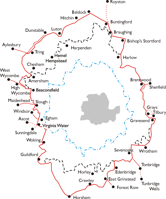
Description: Map of the area of the London Passenger Transport Board 1933 - 1947. Simplified map based on leaflet issued by LPTB, July 1933. The London Passenger Transport Area is outlined in red, with the board's "special area", in which it had a monoply of public transport services, indicated by a broken black line. The boundary of the Metropolitan Police District is shown as a blue broken line, and the County of London is shaded in grey. Broken red lines indicate roads over which the Board was allowed to run services outside its area.
Title: LPTA map
Credit: Transferred from en.wikipedia to Commons.
Author: Lozleader at English Wikipedia
Usage Terms: Creative Commons Attribution-Share Alike 3.0
License: CC-BY-SA-3.0
License Link: http://creativecommons.org/licenses/by-sa/3.0/
Attribution Required?: Yes
Image usage
The following 2 pages link to this image:
