
Image: Lahar, Mount St. Helens
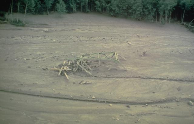
Description: The twisted girders of a highway bridge lie entombed in mudflow deposits from Mount St. Helens. This May 18, 1980 mudflow was produced by dewatering of the debris-avalanche deposit in the North Fork of the Toutle River and traveled as far as the Columbia River, decreasing the depth of the navigational channel from 11 meters to 4 meters.
Title: Lahar, Mount St. Helens
Credit: http://www.volcano.si.edu/world/tpgallery.cfm?category=Lahars%20(mudflows)&photo=028095
Author: Dan Miller, U.S. Geological Survey
Permission: This image is in the public domain in the United States because it only contains materials that originally came from the United States Geological Survey, an agency of the United States Department of the Interior. For more information, see the official USGS copyright policy.
Usage Terms: Public domain
License: Public domain
Attribution Required?: No
Image usage
The following page links to this image:
