
Image: Lake MacKay Australia
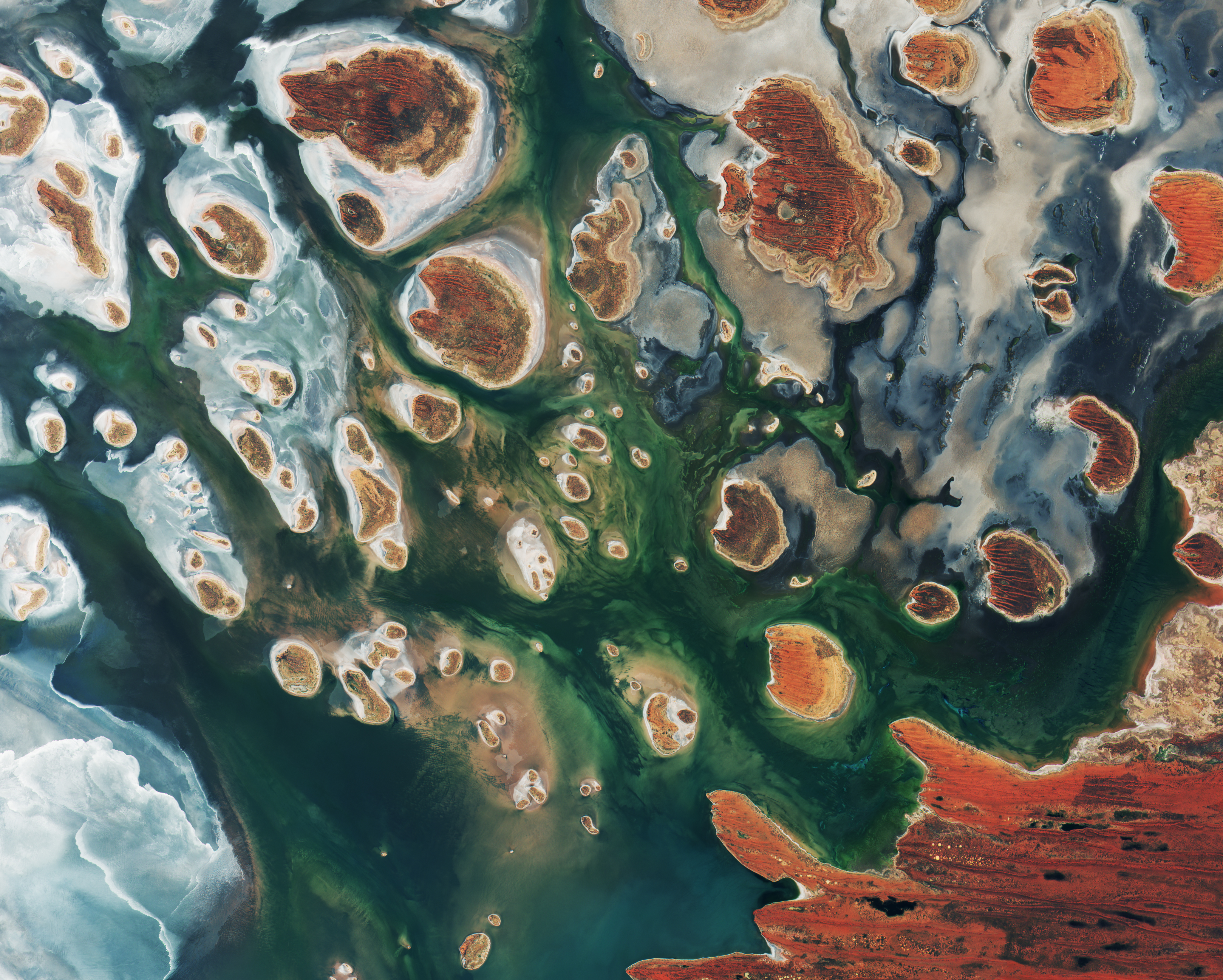
Description: Lake Mackay, Australia, by Copernicus Sentinel-2B satellite. Brown hills speckle the eastern part of Australia’s Lake Mackay in this satellite image. Located on the border of the states of Western Australia and Northern Territory, the salt lake only sees water after seasonal rainfall – if at all. It is classified as an ephemeral lake, meaning it exists only after precipitation. This is not the same as a seasonal lake, which sees water for longer periods. About half of Australia's rivers drain inland and often end in ephemeral salt lakes. The greens and blues in this image show desert vegetation or algae, soil moisture and minerals – mainly salt. On some of the brown ‘islands’ and on the shore in the lower right, we can see the east–west sand ridges forming lines in the landscape. The lake lies at the edge of the Great Sandy Desert, which covers nearly 285,000 sq km. Roads are scarce in the area, and often frequented by four-wheel drive adventurers. Roads include the Canning Stock Route about 300 km to the west of the image, or Tanami Track connecting Australia’s Stuart Highway to the Great Northern Highway around 300 km to the east.
Title: Lake MacKay Australia
Credit: http://www.esa.int/spaceinimages/Images/2017/04/Lake_MacKay_Australia
Author: ESA / Copernicus Sentinel
Usage Terms: Creative Commons Attribution-Share Alike 3.0 igo
License: CC BY-SA 3.0 igo
License Link: https://creativecommons.org/licenses/by-sa/3.0/igo/deed.en
Attribution Required?: Yes
Image usage
The following page links to this image:
