
Image: Lake Superior bathymetry map, deepest point
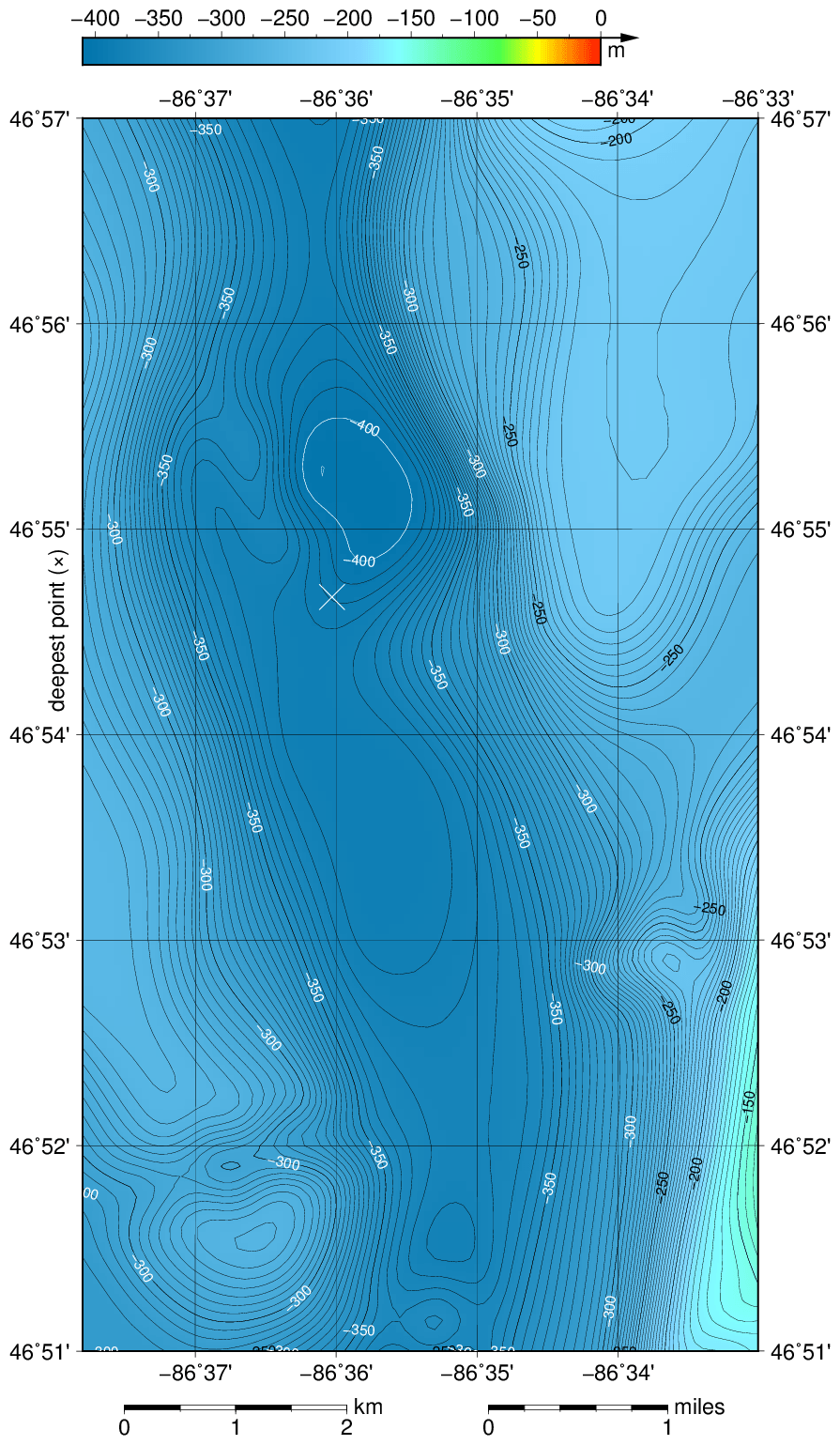
Description: The bathymetric map of Lake Superior portion surrounding the deepest area, contoured with interval 5 m (50 m with thicker lines). The deepest point taken from the GLERL website is marked with "×". It's position differs slightly from the position of the area below -400 m in this bathymetric map based on data cited below. According to NGDC information, Lake Superior data are incomplete. The map was created using the Generic Mapping Tools, GMT, version 5.1.1.
Title: Lake Superior bathymetry map, deepest point
Credit: Own work using: the following Public Domain datasets (grids): Great Lakes Bathymetry from National Geophysical Data Center http://www.ngdc.noaa.gov/mgg/greatlakes/greatlakes.html. Credits: National Geophysical Data Center, 1999. Bathymetry of Lake Superior. National Geophysical Data Center, NOAA. [access date: 2015-03-23]. (the general reference to NGDC because this lake was never published, compilation of Great Lakes Bathymetry at NGDC has been suspended). The coordinates of deepest point are taken from the NOAA Great LakesEnvironmental Research Laboratory webpage (www.glerl.noaa.gov/, kml file Google Earth Great Lakes Tour). The contours are generated by the GMT program, not downloaded from the NGDC website because they are not available for Lake Superior. Created with Generic Mapping Tools (GMT)
Author: Darekk2 using the Great Lakes Bathymetry
Usage Terms: Creative Commons Attribution-Share Alike 4.0
License: CC BY-SA 4.0
License Link: http://creativecommons.org/licenses/by-sa/4.0
Attribution Required?: Yes
Image usage
The following page links to this image:
