
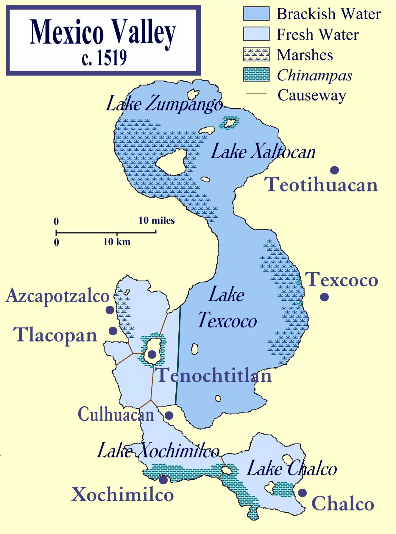
Image: Lake Texcoco c 1519
Size of this preview: 444 × 599 pixels. Other resolutions: 178 × 240 pixels | 1,330 × 1,794 pixels.
Original image (1,330 × 1,794 pixels, file size: 1.64 MB, MIME type: image/png)
Description: This is a map of the Valley of Mexico on the eve of the Spanish conquest of Mexico. It shows the major towns within the Valley, in particular, the island capital of the Aztecs, Tenochtitlan. The map also shows the five lakes that once existed within the Valley, highlighted to differentiate the brackish from the fresh waters. It was compiled from several sources, most prominently those listed below
Title: Lake Texcoco c 1519
Credit: Self-published work by Madman2001
Author: Madman2001
Usage Terms: Creative Commons Attribution-Share Alike 3.0
License: CC-BY-SA-3.0
License Link: http://creativecommons.org/licenses/by-sa/3.0/
Attribution Required?: Yes
Image usage
The following 8 pages link to this image:

All content from Kiddle encyclopedia articles (including the article images and facts) can be freely used under Attribution-ShareAlike license, unless stated otherwise.