
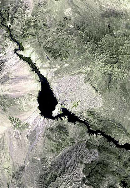
Image: Lake havasu city map

Size of this preview: 416 × 600 pixels. Other resolutions: 166 × 240 pixels | 544 × 784 pixels.
Original image (544 × 784 pixels, file size: 72 KB, MIME type: image/jpeg)
Description: The raw satellite imagery shown in these images was obtained from NASA and/or the US Geological Survey. Post-processing and production by www.terraprints.com; Note: The outfall of the w:Chemehuevi Wash out of Chemehuevi Valley is on the left bank (west) of w:Lake Havasu, at the widest section, just south of left-bank center.
Title: Lake havasu city map
Credit: www.terraprints.com
Author: http://www.terraprints.com
Usage Terms: Creative Commons Attribution 2.5
License: CC BY 2.5
License Link: https://creativecommons.org/licenses/by/2.5
Attribution Required?: Yes
Image usage
The following page links to this image:

All content from Kiddle encyclopedia articles (including the article images and facts) can be freely used under Attribution-ShareAlike license, unless stated otherwise.