
Image: Lancaster1610 - St Helins Region
No higher resolution available.
Lancaster1610_-_St_Helins_Region.png (255 × 150 pixels, file size: 88 KB, MIME type: image/png)
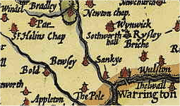
Description: A splice of a 1610 Map showing the local region of Lancaster in 1610
Title: Lancaster1610 - St Helins Region
Credit: Own work
Author: Koncorde (talk)
Usage Terms: Public domain
License: Public domain
Attribution Required?: No
Image usage
The following page links to this image:

All content from Kiddle encyclopedia articles (including the article images and facts) can be freely used under Attribution-ShareAlike license, unless stated otherwise.