
Image: Land surface temperature anomaly over East Asia in January 2016
No higher resolution available.
Land_surface_temperature_anomaly_over_East_Asia_in_January_2016.jpg (720 × 536 pixels, file size: 236 KB, MIME type: image/jpeg)
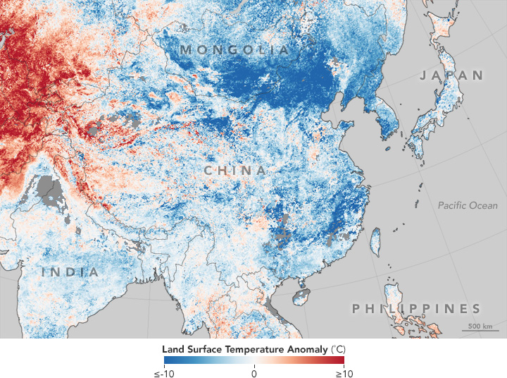
Description: This temperature anomaly map is based on data from the Moderate Resolution Imaging Spectroradiometer (MODIS) on NASA’s Terra satellite. It shows land surface temperatures (LSTs) from January 17–24, 2016, compared to the 2001–2010 average for the same eight-day period.
Usage Terms: Public domain
Image usage
The following page links to this image:

All content from Kiddle encyclopedia articles (including the article images and facts) can be freely used under Attribution-ShareAlike license, unless stated otherwise.