
Image: Landsat-nyc-rockaway
Size of this preview: 800 × 559 pixels. Other resolutions: 320 × 223 pixels | 2,670 × 1,864 pixels.
Original image (2,670 × 1,864 pixels, file size: 10.99 MB, MIME type: image/png)
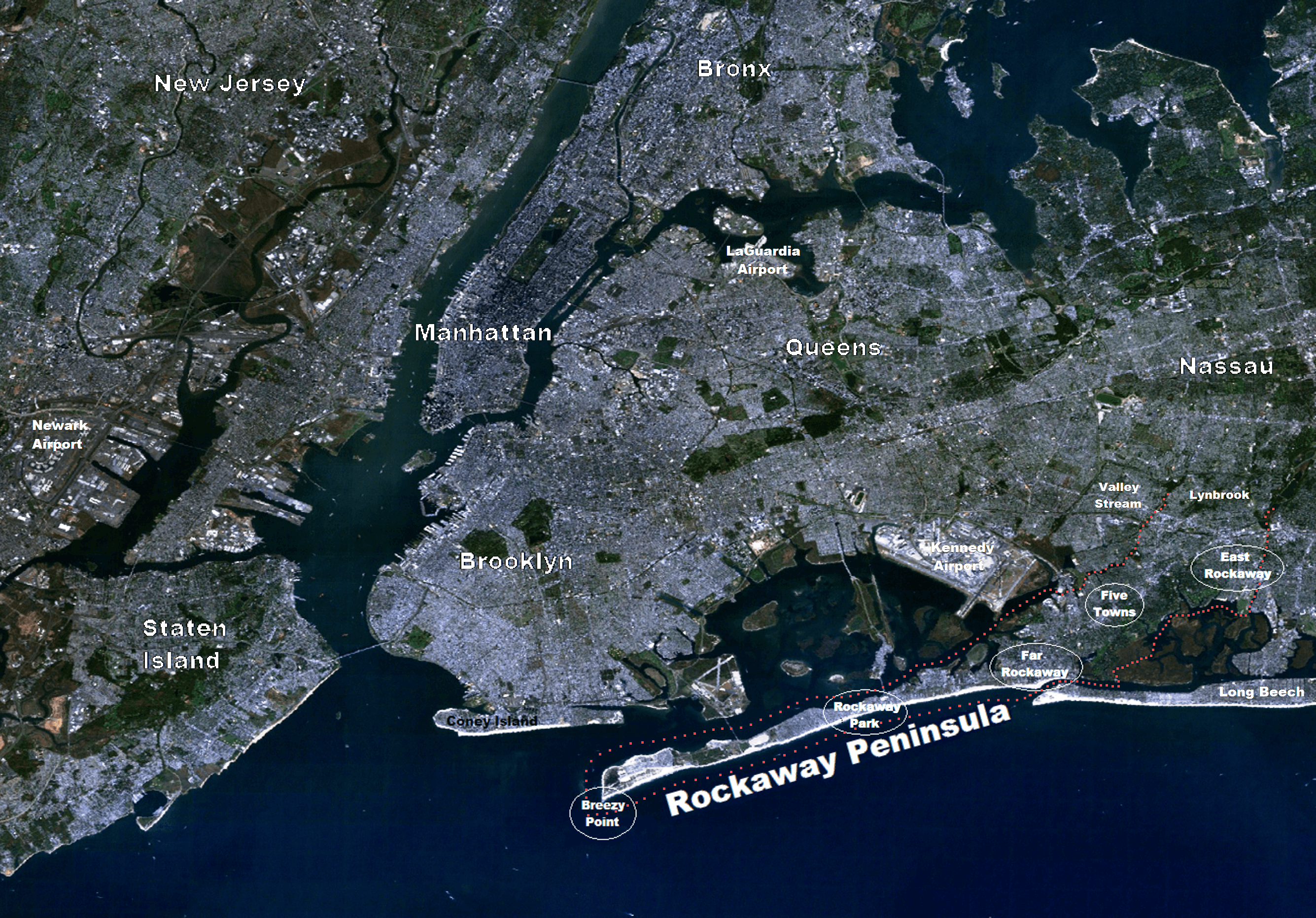
Description: Landsat of NYC Metro Area with emphasis on The Rockaway Peninsula. Red dotted line follows the courses of tidal water to the head of the peninsula in the north-east. (right side of photo)
Title: Landsat-nyc-rockaway
Credit: Landsat7-nyc-metro-small.png from commons.wikimedia by Brian Szymanski
Author: User:Atefrat (adding labels)
Usage Terms: Creative Commons Zero, Public Domain Dedication
License: CC0
License Link: http://creativecommons.org/publicdomain/zero/1.0/deed.en
Attribution Required?: No
Image usage
There are no pages that link to this image.

All content from Kiddle encyclopedia articles (including the article images and facts) can be freely used under Attribution-ShareAlike license, unless stated otherwise.