
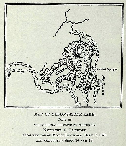
Image: LangfordYellowstoneLakeMap

Size of this preview: 517 × 599 pixels. Other resolutions: 207 × 240 pixels | 653 × 757 pixels.
Original image (653 × 757 pixels, file size: 113 KB, MIME type: image/jpeg)
Description: Map of Yellowstone Lake, 1870 Washburn, Doane and Langford Expedition
Title: LangfordYellowstoneLakeMap
Credit: Extracted from Public Domain PDF File of DIARY OF THE WASHBURN EXPEDITION TO THE YELLOWSTONE AND FIREHOLE RIVERS IN THE YEAR 1870 BY NATHANIEL PITT LANGFORD (1905), on the Internet Archive
Author: Mike Cline
Usage Terms: Public domain
License: Public domain
Attribution Required?: No
Image usage
The following 5 pages link to this image:

All content from Kiddle encyclopedia articles (including the article images and facts) can be freely used under Attribution-ShareAlike license, unless stated otherwise.