
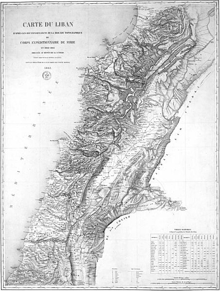
Image: Lebanon as envisaged by French General Charles-Marie-Napoléon de Beaufort d'Hautpoul Beaufort d'Hautpoul in 1862

Size of this preview: 455 × 600 pixels. Other resolutions: 182 × 240 pixels | 1,820 × 2,400 pixels.
Original image (1,820 × 2,400 pixels, file size: 515 KB, MIME type: image/jpeg)
Description: Carte du Liban d'apres les reconnaissances de la brigade topographique du corps expeditionnaire de Syrie en 1860-1861 dressee au depot de la guerre. Lebanon as envisaged by French General Beaufort d'Hautpoul in 1862. This map defined the territory of Greater Lebanon as agreed at the 1919 Paris Peace Conference.
Title: Lebanon as envisaged by French General Charles-Marie-Napoléon de Beaufort d'Hautpoul Beaufort d'Hautpoul in 1862
Credit: Bibliothèque nationale de France
Author: Charles-Marie-Napoléon de Beaufort d'Hautpoul
Usage Terms: Public domain
License: Public domain
Attribution Required?: No
Image usage
There are no pages that link to this image.

All content from Kiddle encyclopedia articles (including the article images and facts) can be freely used under Attribution-ShareAlike license, unless stated otherwise.