
Image: Leonhard Euler World Map AD1760

Size of this preview: 696 × 599 pixels. Other resolutions: 279 × 240 pixels | 2,615 × 2,252 pixels.
Original image (2,615 × 2,252 pixels, file size: 2.79 MB, MIME type: image/jpeg)
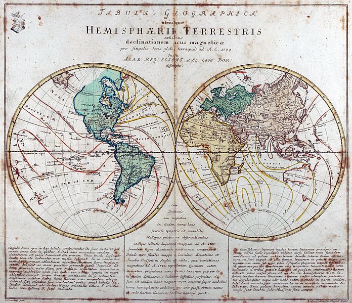
Description: Engraved world map (including magnetic declination lines) by Leonhard Euler from his school atlas “Geographischer Atlas bestehend in 44 Land-Charten” first published 1753 in Berlin
Title: Leonhard Euler World Map AD1760
Credit: Antique-World: Antique World Map by Leonhard Euler
Author: Leonhard Euler
Permission: Own work
Usage Terms: Public domain
License: Public domain
Attribution Required?: No
Image usage
There are no pages that link to this image.

All content from Kiddle encyclopedia articles (including the article images and facts) can be freely used under Attribution-ShareAlike license, unless stated otherwise.