
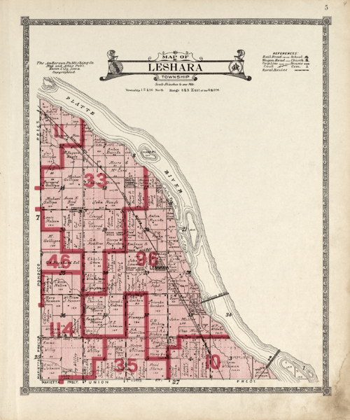
Image: Leshara Township (1916)

Size of this preview: 500 × 600 pixels. Other resolutions: 200 × 240 pixels | 2,268 × 2,721 pixels.
Original image (2,268 × 2,721 pixels, file size: 4.99 MB, MIME type: image/png)
Description: Map of Leshara Township included in the Atlas of Saunders County, Nebraska (1916).
Title: Leshara Township (1916)
Credit: https://www.loc.gov/resource/g4193sm.gla00040/?sp=6
Author: Anderson Publishing Company. Mason City, Iowa
Usage Terms: Public domain
License: Public domain
Attribution Required?: No
Image usage
The following page links to this image:

All content from Kiddle encyclopedia articles (including the article images and facts) can be freely used under Attribution-ShareAlike license, unless stated otherwise.
.png)