
Image: Lituya Bay overview
No higher resolution available.
Lituya_Bay_overview.jpg (750 × 580 pixels, file size: 111 KB, MIME type: image/jpeg)
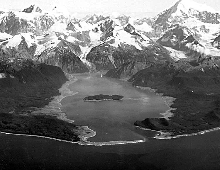
Description: Lituya Bay a few weeks after the 1958 tsunami. The areas of destroyed forest along the shorelines are clearly recognizable as the light areas rimming the bay. A fishing boat anchored in the cove at lower left was carried over the spit in the foreground; a boat under way near the entrance was sunk; and a third boat, anchored near the lower right, rode out the wave. Photo by D.J. Miller, United States Geological Survey.
Title: Lituya Bay overview
Credit: USGS via [1]
Author: D.J. Miller, United States Geological Survey
Usage Terms: Public domain
License: Public domain
Attribution Required?: No
Image usage
The following page links to this image:

All content from Kiddle encyclopedia articles (including the article images and facts) can be freely used under Attribution-ShareAlike license, unless stated otherwise.