
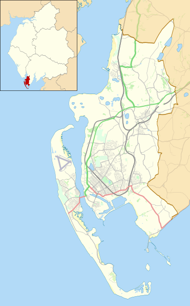
Image: Location map United Kingdom Borough of Barrow-in-Furness

Description: Map of the Borough of Barrow-in-Furness, in Cumbria, England, in 2021. Geographic limits: West: 3.33° W East: 3.13° W North: 54.23° N South: 54.04° N Key Primary route Other A road Other road Railway River
Title: Location map United Kingdom Borough of Barrow-in-Furness
Credit: This file was derived from: Barrow-in-Furness unparished area UK locator map.svg: https://www.openstreetmap.org/#map=19/54.04009/-3.13030 accessed 24 January 2021
Author: Barrow-in-Furness unparished area UK locator map.svg: Nilfanion, created using Ordnance Survey data OpenStreetMap: OpenStreetMap contributors derivative work: Dr Greg
Usage Terms: Creative Commons Attribution-Share Alike 4.0
License: CC BY-SA 4.0
License Link: https://creativecommons.org/licenses/by-sa/4.0
Attribution Required?: Yes
Image usage
The following 8 pages link to this image:
