
Image: Location map United Kingdom Fleetwood

Size of this PNG preview of this SVG file: 450 × 599 pixels. Other resolution: 180 × 240 pixels.
Original image (SVG file, nominally 1,266 × 1,686 pixels, file size: 3.62 MB)
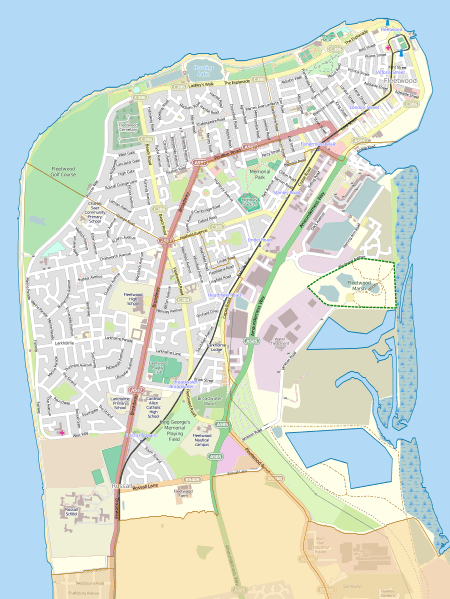
Description: Map of Fleetwood, Lancashire, England. Equirectangular map projection on WGS 84 datum Geographic limits: West: 3.053 °W East: 3.002 °W North: 53.930 °N South: 53.890 °N
Title: Location map United Kingdom Fleetwood
Credit: This file was derived from: Wyre UK ward map 2010 (blank).svg: http://www.openstreetmap.org/#map=13/53.9101/-3.0274
Author: Wyre UK ward map 2010 (blank).svg: Nilfanion, created using Ordnance Survey data OpenStreetMap: OpenStreetMap contributors derivative work: Dr Greg
Usage Terms: Creative Commons Attribution-Share Alike 2.0
License: CC BY-SA 2.0
License Link: https://creativecommons.org/licenses/by-sa/2.0
Attribution Required?: Yes
Image usage
The following 2 pages link to this image:

All content from Kiddle encyclopedia articles (including the article images and facts) can be freely used under Attribution-ShareAlike license, unless stated otherwise.