
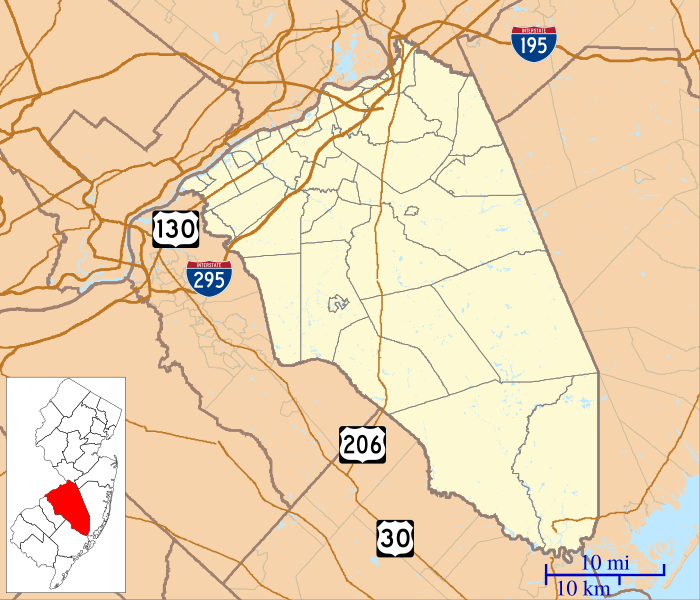
Image: Location map of Burlington County, New Jersey

Size of this PNG preview of this SVG file: 700 × 600 pixels. Other resolution: 280 × 240 pixels.
Original image (SVG file, nominally 896 × 768 pixels, file size: 1.22 MB)
Description: This is a map of Burlington County, New Jersey, USA which includes incorporated settlements, township borders, and major highways.
Title: Location map of Burlington County, New Jersey
Credit: My own work, using custom-written MapScript applications with United States Census Bureau data
Author: Omnedon
Usage Terms: Public domain
License: Public domain
Attribution Required?: No
Image usage
More than 100 pages link to this image. The following list shows the first 100 page links to this image only. A full list is available.
- Arney's Mount Friends Meetinghouse and Burial Ground
- Arneys Mount, New Jersey
- Arneytown, New Jersey
- Atsion, New Jersey
- Batsto Village, New Jersey
- Beaverville, New Jersey
- Beverly, New Jersey
- Birmingham, New Jersey
- Bordentown, New Jersey
- Bridgeboro, New Jersey
- Browns Mills Junction, New Jersey
- Buddtown, New Jersey
- Bullock, New Jersey
- Burlington, New Jersey
- Burlington Historic District (Burlington, New Jersey)
- Chairville, New Jersey
- Chambers Corner, New Jersey
- Chatsworth, New Jersey
- Chesterfield Township, New Jersey
- Christopher Mills, New Jersey
- Cinnaminson Township, New Jersey
- Clermont, Burlington County, New Jersey
- Columbus, New Jersey
- Comical Corner, New Jersey
- Cookstown, New Jersey
- Cropwell, New Jersey
- Crossroads, New Jersey
- Crosswicks, New Jersey
- Davisville, New Jersey
- Delanco Township, New Jersey
- Delran Township, New Jersey
- Dunns Mill, New Jersey
- Eastampton Township, New Jersey
- Eayrestown, New Jersey
- Ellisdale, New Jersey
- Evesboro, New Jersey
- Evesham Township, New Jersey
- Ewansville, New Jersey
- Fairview, Medford, New Jersey
- Fellowship, New Jersey
- Fieldsboro, New Jersey
- Florence (CDP), New Jersey
- Florence Township, New Jersey
- Fort Dix
- Fostertown, New Jersey
- Four Mile, New Jersey
- Francis Hopkinson House
- Georgetown, New Jersey
- Green Bank, New Jersey
- Hainesport Township, New Jersey
- Harrisville, New Jersey
- Hartford, New Jersey
- Hedding, New Jersey
- High Crossing, New Jersey
- High Street Historic District (Burlington, New Jersey)
- Indian Mills, New Jersey
- Ivywood, New Jersey
- Jacksonville, New Jersey
- Jacobstown, New Jersey
- Jobstown, New Jersey
- Juliustown, New Jersey
- Kinkora, New Jersey
- Kirby's Mill
- Lumberton, New Jersey
- Mansfield Township, Burlington County, New Jersey
- Maple Shade Township, New Jersey
- Marlboro, Burlington County, New Jersey
- Masonville, New Jersey
- Medford, New Jersey
- Medford Lakes, New Jersey
- Moorestown, New Jersey
- Mount Holly, New Jersey
- Mount Laurel, New Jersey
- New Albany, New Jersey
- New Gretna, New Jersey
- New Hanover Township, New Jersey
- New Lisbon, New Jersey
- Newbolds Corner, New Jersey
- North Hanover Township, New Jersey
- Old Upper Springfield Friends Burying Ground
- Ong's Hat, New Jersey
- Palmyra, New Jersey
- Pemberton, New Jersey
- Rancocas, New Jersey
- Rancocas Woods, New Jersey
- Red Lion, Burlington County, New Jersey
- Retreat, New Jersey
- Sandtown, New Jersey
- Shamong Township, New Jersey
- Smithville, Burlington County, New Jersey
- Sooy Place, New Jersey
- Southampton Township, New Jersey
- Springfield Township, Burlington County, New Jersey
- Tabernacle Township, New Jersey
- Vincentown, New Jersey
- Washington Township, Burlington County, New Jersey
- Westampton, New Jersey
- Willingboro Township, New Jersey
- Woodland Township, New Jersey
- Woodlane, New Jersey

All content from Kiddle encyclopedia articles (including the article images and facts) can be freely used under Attribution-ShareAlike license, unless stated otherwise.