
Image: Location map of Champaign County, Illinois

Size of this PNG preview of this SVG file: 600 × 600 pixels. Other resolution: 240 × 240 pixels.
Original image (SVG file, nominally 768 × 768 pixels, file size: 196 KB)
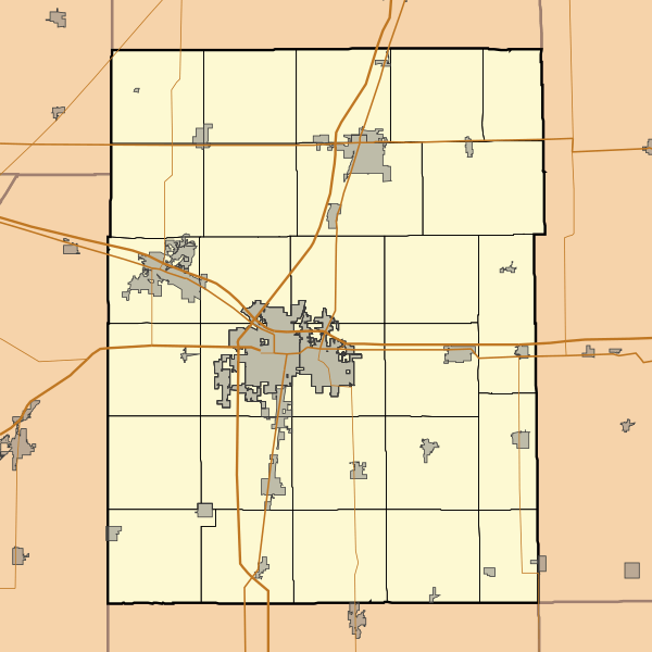
Description: This is a map of Champaign County, Illinois, USA which includes township borders.
Title: Location map of Champaign County, Illinois
Credit: My own work, using custom-written MapScript applications with National Atlas and United States Census Bureau data
Author: Omnedon
Usage Terms: Public domain
License: Public domain
Attribution Required?: No
Image usage
The following 17 pages link to this image:
- Gifford, Illinois
- Homer, Illinois
- Ivesdale, Illinois
- Longview, Illinois
- Ludlow, Illinois
- Mahomet, Illinois
- Ogden, Illinois
- Pesotum, Illinois
- Philo, Illinois
- Rantoul, Illinois
- Royal, Illinois
- Sadorus, Illinois
- Savoy, Illinois
- Sidney, Illinois
- St. Joseph, Illinois
- Thomasboro, Illinois
- Tolono, Illinois

All content from Kiddle encyclopedia articles (including the article images and facts) can be freely used under Attribution-ShareAlike license, unless stated otherwise.