
Image: Location map of Montgomery County, Indiana

Size of this PNG preview of this SVG file: 600 × 600 pixels. Other resolution: 240 × 240 pixels.
Original image (SVG file, nominally 960 × 960 pixels, file size: 1.32 MB)
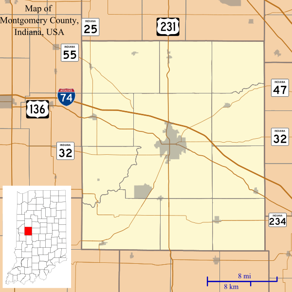
Description: This is a map of Montgomery County, Indiana, USA which includes incorporated settlements, township borders, and major highways.
Title: Location map of Montgomery County, Indiana
Credit: Source=My own work, using custom-written MapScript applications with United States Census Bureau TIGER 2013 data
Author: Omnedon
Usage Terms: Public domain
License: Public domain
Attribution Required?: No
Image usage
The following 31 pages link to this image:
- Alamo, Indiana
- Balhinch, Indiana
- Beckville, Indiana
- Bowers, Indiana
- Browns Valley, Indiana
- Cherry Grove, Indiana
- Crawfordsville, Indiana
- Darlington, Indiana
- Darlington Woods, Indiana
- Elmdale, Indiana
- Garfield, Indiana
- Hibernia, Montgomery County, Indiana
- Kirkpatrick, Indiana
- Ladoga, Indiana
- Lake Holiday, Indiana
- Lapland, Indiana
- Linden, Indiana
- Linnsburg, Indiana
- Mace, Indiana
- New Market, Indiana
- New Richmond, Indiana
- New Ross, Indiana
- North Union, Indiana
- Parkersburg, Indiana
- Shannondale, Indiana
- Smartsburg, Indiana
- Waveland, Indiana
- Waynetown, Indiana
- Wesley, Indiana
- Whitesville, Indiana
- Yountsville, Indiana

All content from Kiddle encyclopedia articles (including the article images and facts) can be freely used under Attribution-ShareAlike license, unless stated otherwise.