
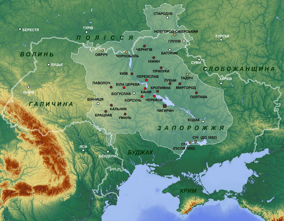
Image: Location of Cossack Hetmanate
Size of this preview: 771 × 600 pixels. Other resolutions: 309 × 240 pixels | 964 × 750 pixels.
Original image (964 × 750 pixels, file size: 1.68 MB, MIME type: image/png)
Description: Cossack Hetmanate 1649–1654
Title: Location of Cossack Hetmanate
Credit: http://www.maps-for-free.com/
Author: Alex K; І.П.Крип’якевич. Богдан Хмельницький (передмова Я.Д.Ісаєвича). – Львів: Світ, 1990. І.П.Крип’якевич. Історія України (передмова Я.Д.Дашкевича, коментарі Б.З.Якимовича). – Львів: Світ, 1990. Енциклопедія українського козацтва. Карти. Заруба В. М. Адміністративно-територіальнй устрій та адміністрація Війська Запорізького у 1648 - 1782 рр. Дніпропетровськ, 2007
Permission: GFDL; http://www.maps-for-free.com/html/about.html
Usage Terms: GNU Free Documentation License
License: GFDL
License Link: http://www.gnu.org/copyleft/fdl.html
Attribution Required?: Yes
Image usage
The following 2 pages link to this image:

All content from Kiddle encyclopedia articles (including the article images and facts) can be freely used under Attribution-ShareAlike license, unless stated otherwise.